Sites and Monuments Record · Ireland
Moated site
Templeshelin, County Wexford, Ireland
The record
- Townland
- Templeshelin
- County
- Wexford
- Country
- Ireland
- First-edition OS map
- Indicated
- Latest-edition OS map
- Indicated
- Coordinates
- 52.40128, -6.76366
- SMR number
- WX030-042----
Slide toward Today to fade the historical sheet and see the modern map underneath.
University Library, Vrije Universiteit AmsterdamUniversity Library, Vrije Universiteit AmsterdamDavid Rumsey Map Collection, Stanford LibrariesDavid Rumsey Map Collection, Stanford Libraries
4 historical maps cover this location, the earliest the 1790 map "Composite: Ireland." (David Rumsey Map Collection, Stanford Libraries).
Historical maps covering this location
- 1790 · Composite: Ireland. (David Rumsey Map Collection, Stanford Libraries)
- 1891 · Ireland 16 (David Rumsey Map Collection, Stanford Libraries)
- 1904 · Sheet 14, 1904 (University Library, Vrije Universiteit Amsterdam)
- 1911 · Sheet 14, 1911 (University Library, Vrije Universiteit Amsterdam)
This record in the National Monuments Service's Historic Environment Viewer ↗
The National Monuments Service's description
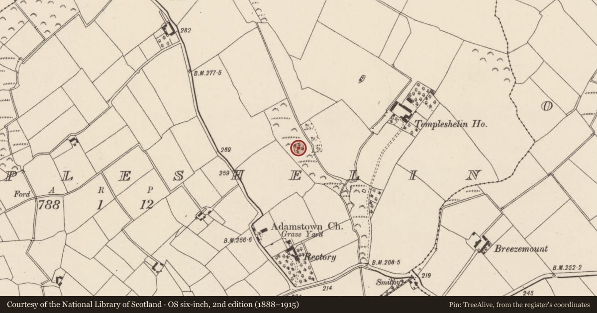
Marked as a small square wooded enclosure on the 1839 (dims. c. 40m x c. 30m) and 1925 (dims. c. 30m x c. 25m) eds of the OS 6-inch map. It is situated in the bottom of a shallow NNW-SSE valley with a stream c. 20m to the E. This is a square area (dims. 31m N-S; 31m E-W) in a small coniferous wood defined by earthen banks (Wth 5-7m; int. H c. 1-1.5m; ext. H 1.8-2m normally but 3.4m over a stream at S) at the N, S and W sides, and flat bottomed external moats (Wth of top 5.5-6.5m; ext. D 1.2-2m) on each side. The bank is augmented by spoil from the digging of an inner drain on all sides except the E where the bank was probably removed, and the stream was diverted into the moat at S and now runs off to the S from the SW angle.
The above description is derived from the published 'Archaeological Inventory of County Wexford' (Dublin: Stationery Office, 1996). In certain instances the entries have been revised and updated in the light of recent research.
Compiled by: Michael Moore
Date of upload/revision: 16 August, 2012
Nearby in the register
- Ringfort - rathunder 1 mi
- Ritual site - holy wellunder 1 mi
- Churchunder 1 mi
- Standing stoneunder 1 mi
Other entries of the same register within about three miles of this one, by straight line.