Sites and Monuments Record · Ireland
Excavation - miscellaneous
Southknock, County Wexford, Ireland
The record
- Townland
- Southknock
- County
- Wexford
- Country
- Ireland
- First-edition OS map
- Not indicated
- Latest-edition OS map
- Not indicated
- Coordinates
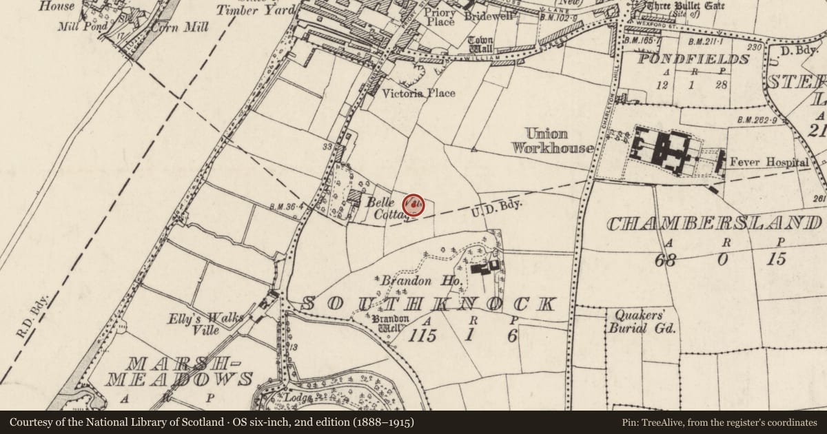
- 52.38832, -6.94663
- SMR number
- WX029-038----
Slide toward Today to fade the historical sheet and see the modern map underneath.
University Library, Vrije Universiteit AmsterdamUniversity Library, Vrije Universiteit AmsterdamDavid Rumsey Map Collection, Stanford LibrariesDavid Rumsey Map Collection, Stanford Libraries
4 historical maps cover this location, the earliest the 1790 map "Composite: Ireland." (David Rumsey Map Collection, Stanford Libraries).
Historical maps covering this location
- 1790 · Composite: Ireland. (David Rumsey Map Collection, Stanford Libraries)
- 1891 · Ireland 16 (David Rumsey Map Collection, Stanford Libraries)
- 1904 · Sheet 14, 1904 (University Library, Vrije Universiteit Amsterdam)
- 1911 · Sheet 14, 1911 (University Library, Vrije Universiteit Amsterdam)
This record in the National Monuments Service's Historic Environment Viewer ↗
The National Monuments Service's description
Situated towards the top of a W and S-facing slope overlooking the N-S River Barrow/Nore that is c. 400m to the W, and located c. 300m S of the S line of the town wall of New Ross (WX029-013005-). Archaeological testing and monitoring (03E1638) of an extensive housing development recorded a hearth as a oval feature (dims. 1.35m x 0.7m; D 0.12m) filled with two deposits containing charcoal on the fire-reddened clay. Two small pits (dims. 1m x 0.6m; D 0.18m: 1.4m x 0.6m; D 0.35m) were c. 40m to the S. The features produced no artefacts, but over 500 sherds of pottery, mostly post-medieval, was recovered in monitoring. (Mcloughlin 2005, 5, 2007c)
Compiled by: Michael Moore
Date of upload: 7 August, 2012
References
McLoughlin, C. 2005 Archaeological monitoring report, Southknock, New Ross, Co. Wexford. Unpublished report. Stafford/McLoughlin Archaeology.
McLoughlin, C. 2007 Southknock, New Ross. Post-medieval, in I. Bennett (ed.), Excavations 2004: summary accounts of archaeological excavations in Ireland, 469-70, No. 1819. Dublin, Wordwell.
Nearby in the register
- Ritual site - holy wellunder 1 mi
- Religious house - Fratres Cruciferiunder 1 mi
- Burial groundunder 1 mi
- Burialunder 1 mi
Other entries of the same register within about three miles of this one, by straight line.