Sites and Monuments Record · Ireland
Church
New Ross, County Wexford, Ireland
The record
- Townland
- New Ross
- County
- Wexford
- Country
- Ireland
- First-edition OS map
- Not indicated
- Latest-edition OS map
- Not indicated
- Coordinates
- 52.39312, -6.94498
- SMR number
- WX029-013074-
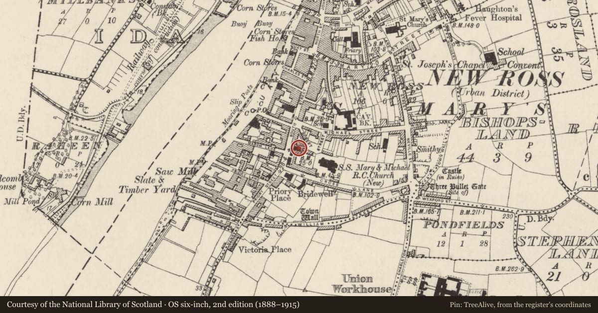
Slide toward Today to fade the historical sheet and see the modern map underneath.
University Library, Vrije Universiteit AmsterdamUniversity Library, Vrije Universiteit AmsterdamDavid Rumsey Map Collection, Stanford LibrariesDavid Rumsey Map Collection, Stanford Libraries
4 historical maps cover this location, the earliest the 1790 map "Composite: Ireland." (David Rumsey Map Collection, Stanford Libraries).
Historical maps covering this location
- 1790 · Composite: Ireland. (David Rumsey Map Collection, Stanford Libraries)
- 1891 · Ireland 16 (David Rumsey Map Collection, Stanford Libraries)
- 1904 · Sheet 14, 1904 (University Library, Vrije Universiteit Amsterdam)
- 1911 · Sheet 14, 1911 (University Library, Vrije Universiteit Amsterdam)
This record in the National Monuments Service's Historic Environment Viewer ↗
The National Monuments Service's description
St Saviour's church, about which little is known except that it was a chantry chapel in existence in 1280 and that the advowson, or right of appointing clergy, was granted to Dunbrody (WX039- 030001-) in 1370, was close to the site where Thomas Gregory founded a Hospital of the Holy Trinity (WX029-013011-). Hore (1900-11, vol. 1, 72-84, 143) argues that it was a Dominican foundation of 1267 because the name St. Saviour’s is associated with the Dominican’s and they are recorded as estabalishing a locus or postion in New Ross in that year. FFrench (1898) argues unconvincingly that this church maintained the lighthouse of Hook (WX054-010----). The location is not precisely known, but it may be where St. Catherine's, a chapel-of-ease to St. Mary's Church of Ireland church that was built in 1833.
Compiled by: Michael Moore
Date of upload: 2 August, 2012
Amended: 24 March, 2014
References
Hore, P.H. 1900-1911 (Reprint 1979) History of the town and county of Wexford, 6 vols. Dublin. Published by arrangement with W.A. Hennessy Esq.
Ffrench, Rev. J. F. M. 1898 Where was the church of St. Saviour of Rendenan situated? Journal of the Waterford and south-east of Ireland archaeological society, vol. 4, 16-20
Nearby in the register
- Hospitalunder 1 mi
- Excavation - miscellaneousunder 1 mi
- Burialunder 1 mi
- Religious house - Augustinian friarsunder 1 mi
Other entries of the same register within about three miles of this one, by straight line.