Sites and Monuments Record · Ireland
Excavation - miscellaneous
Oulartard, County Wexford, Ireland
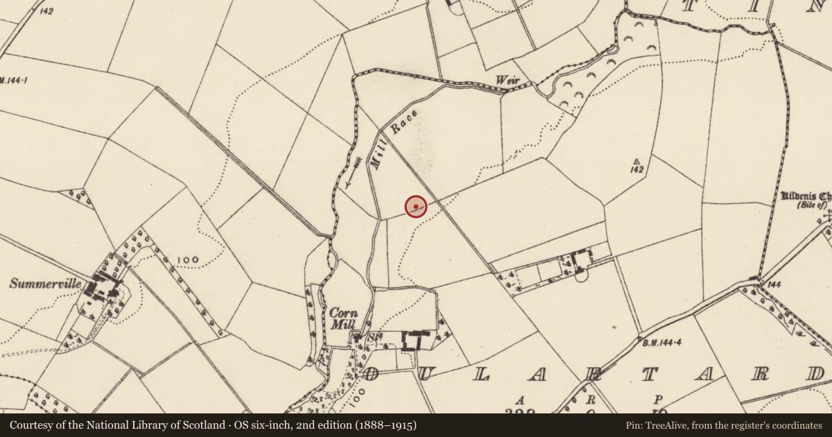
The record
- Townland
- Oulartard
- County
- Wexford
- Country
- Ireland
- First-edition OS map
- Not indicated
- Latest-edition OS map
- Not indicated
- Coordinates
- 52.54239, -6.49945
- SMR number
- WX020-081----
Slide toward Today to fade the historical sheet and see the modern map underneath.
University Library, Vrije Universiteit AmsterdamUniversity Library, Vrije Universiteit AmsterdamDavid Rumsey Map Collection, Stanford LibrariesDavid Rumsey Map Collection, Stanford Libraries
4 historical maps cover this location, the earliest the 1811 map "Ireland." (David Rumsey Map Collection, Stanford Libraries).
Historical maps covering this location
- 1811 · Ireland. (David Rumsey Map Collection, Stanford Libraries)
- 1891 · Ireland 16 (David Rumsey Map Collection, Stanford Libraries)
- 1904 · Sheet 14, 1904 (University Library, Vrije Universiteit Amsterdam)
- 1911 · Sheet 14, 1911 (University Library, Vrije Universiteit Amsterdam)
This record in the National Monuments Service's Historic Environment Viewer ↗
The National Monuments Service's description
Identified in centre-line testing (E4110) in advance of the M11 Gorey to Enniscorthy road scheme and resolved by A. Mulcahy as Oulartard 1 (E4350) during the testing stage (Hardy et al. 2010, 70). It is situated on a W-facing slope with a N-S stream c. 200m to the W. This is a single pit (dims 0.9m x 0.8m; D 0.1m) filled with a black silty clay with frequent charcoal and moderate stone inclusions. A sample provided a C14 date of Cal. BC 3748-3532, providing an Early Neolithic date. The pit (WX020-082----) c. 35m to the E is completely unconnected with this feature. (Mulcahy 2011; 2013)
Compiled by: Michael Moore
Date of upload; 28 November, 2013
References
Mulcahy, A. 2011 M11 Gorey to Enniscorthy scheme, Co. Wexford. E4350, Oulartard 1. Stage (IV) Final Excavation Report for Wexford County Council. Unpublished report, TVAS (Ireland).
Mulcahy, A. 2013 Oulartard 1. Pit. In I. Bennett (ed.), Excavations 2010: summary accounts of archaeological excavations in Ireland, 257, No. 806. Dublin. Wordwell.
Hardy, C., Nugent, L., Homan Reid, R; O'Liathain, N; Whitty, Y.; and Coleman, C. 2010 N11 Gorey to Enniscorthy scheme. Archaeological Consultancy Services, Stage (1)a. E4110. Testing report for Wexford County Council. Unpublished. TVAS (Ireland).
Nearby in the register
- Excavation - miscellaneousunder 1 mi
- Burnt moundunder 1 mi
- Burnt moundunder 1 mi
- Churchunder 1 mi
Other entries of the same register within about three miles of this one, by straight line.