Sites and Monuments Record · Ireland
Church
Enniscorthy, County Wexford, Ireland
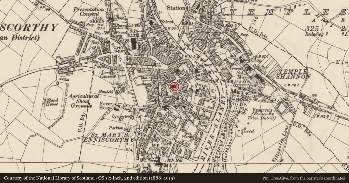
The record
- Townland
- Enniscorthy
- County
- Wexford
- Country
- Ireland
- First-edition OS map
- Church
- Latest-edition OS map
- Ch.
- Coordinates
- 52.50087, -6.56804
- SMR number
- WX020-031004-
Slide toward Today to fade the historical sheet and see the modern map underneath.
University Library, Vrije Universiteit AmsterdamUniversity Library, Vrije Universiteit AmsterdamDavid Rumsey Map Collection, Stanford LibrariesDavid Rumsey Map Collection, Stanford Libraries
4 historical maps cover this location, the earliest the 1811 map "Ireland." (David Rumsey Map Collection, Stanford Libraries).
Historical maps covering this location
- 1811 · Ireland. (David Rumsey Map Collection, Stanford Libraries)
- 1891 · Ireland 16 (David Rumsey Map Collection, Stanford Libraries)
- 1904 · Sheet 14, 1904 (University Library, Vrije Universiteit Amsterdam)
- 1911 · Sheet 14, 1911 (University Library, Vrije Universiteit Amsterdam)
This record in the National Monuments Service's Historic Environment Viewer ↗
The National Monuments Service's description
Situated on a steep E-facing slope down to the NW-SE River Slaney, c. 160m to the NE. This is the site of the parish church of St Mary's, Enniscorthy. References date at least from 1433 (Leslie 1936, 149). According to a Visitation by Thomas Ram, the Protestant bishop of Ferns, in 1615 it was impropriate to Kilcolgan, John Hughes was the curate, and the church and chancel were in repair (Hore 1900-11, vol. 6, 272). The church was damaged in the 1798 rebellion and the present Church of Ireland church was built on the site in 1846. There are no visible remains of older structure within the subrectangular graveyard (dims. c. 55m E-W; c. 30-50m N-S). Archaeological testing (02E0540) in the area S of the present graveyard demonstrated that the graveyard was once more extensive (Stafford 2004).
Compiled by: Michael Moore
Date of upload/revision: 31 May, 2012
Amended: 4 Sep. 2013
References
Leslie, J.B. 1936 Ferns clergy and parishes. Dublin. Privately published.
Stafford, E. 2004 Court Street, Enniscorthy. Urban, burials. in I. Bennett (ed.), Excavations 2002. Summary accounts of archaeological excavations in Ireland, 516, No. 1911. Wordwell. Bray
Nearby in the register
- Graveyardunder 1 mi
- Historic townunder 1 mi
- Castle - tower houseunder 1 mi
- Cross (present location)under 1 mi
Other entries of the same register within about three miles of this one, by straight line.