Sites and Monuments Record · Ireland
Fulacht fia
Askinch Lower, County Wexford, Ireland
The record
- Townland
- Askinch Lower
- County
- Wexford
- Country
- Ireland
- First-edition OS map
- Not indicated
- Latest-edition OS map
- Fulacht Fian
- Coordinates
- 52.78532, -6.25836
- SMR number
- WX003A002----
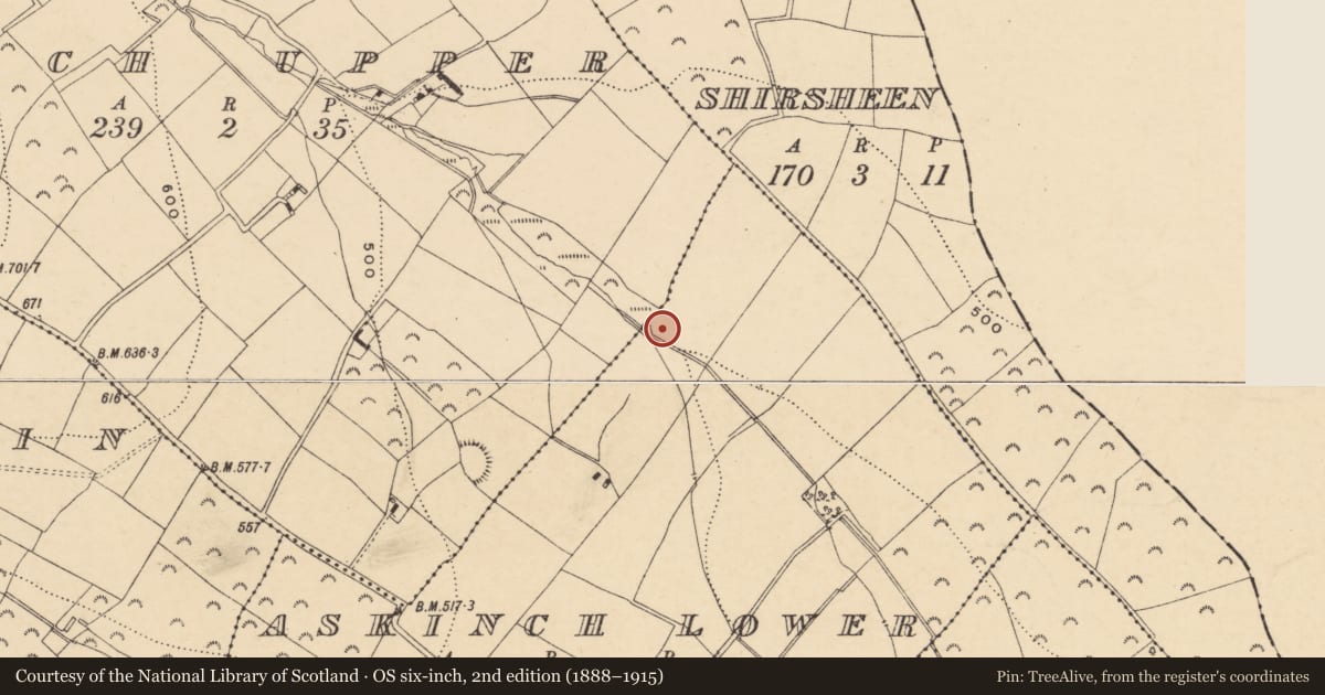
Slide toward Today to fade the historical sheet and see the modern map underneath.
David Rumsey Map Collection, Stanford LibrariesDavid Rumsey Map Collection, Stanford LibrariesDavid Rumsey Map Collection, Stanford LibrariesDavid Rumsey Map Collection, Stanford Libraries
4 historical maps cover this location, the earliest the 1799 map "Ireland." (David Rumsey Map Collection, Stanford Libraries).
Historical maps covering this location
- 1799 · Ireland. (David Rumsey Map Collection, Stanford Libraries)
- 1811 · Ireland. (David Rumsey Map Collection, Stanford Libraries)
- 1841 · Ireland. (David Rumsey Map Collection, Stanford Libraries)
- 1891 · Ireland 16 (David Rumsey Map Collection, Stanford Libraries)
This record in the National Monuments Service's Historic Environment Viewer ↗
The National Monuments Service's description
Marked 'fulacht fian' only on the 1940 ed. of the OS 6-inch map, and situated on the NE bank of a NW-SE stream. It was described in 1940 as an oval mound (dims of base c. 14m NW-SE; 9m NE-SW; H 1.5-2m) of broken and burnt stone (OSFM). It was not visible at ground level in scrubland beside the stream in 1987.
The above description is derived from the published 'Archaeological Inventory of County Wexford' (Dublin: Stationery Office, 1996). In certain instances the entries have been revised and updated in the light of recent research.
Compiled by: Michael Moore
Date of upload/revision: 20 November, 2012
References
OSFM. Ordnance Survey Field Memorandums. A collection of survey notes and descriptions of monuments on pro-forma sheets compiled by Ordnance Survey field staff in the course of the 1:2500 map revision of various counties, mostly dating from 1931 – early 1960s. These unpublished manuscripts form part of the records of the Archaeological Survey of Ireland, National Monuments Service Archive, Dublin.
Nearby in the register
- Ringfort - rathunder 1 mi
- Ringfort - rathunder 1 mi
- Ringfort - rathunder 1 mi
- Ringfort - unclassified1 mi
Other entries of the same register within about three miles of this one, by straight line.