Sites and Monuments Record · Ireland
Ringfort - rath
Keelbeg, County Westmeath, Ireland
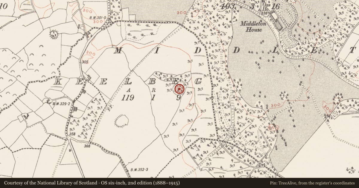
The record
- Townland
- Keelbeg
- County
- Westmeath
- Country
- Ireland
- First-edition OS map
- Outlined
- Latest-edition OS map
- Outlined
- Coordinates
- 53.43319, -7.47792
- SMR number
- WM032-050----
Slide toward Today to fade the historical sheet and see the modern map underneath.
David Rumsey Map Collection, Stanford LibrariesDavid Rumsey Map Collection, Stanford LibrariesDavid Rumsey Map Collection, Stanford LibrariesDavid Rumsey Map Collection, Stanford Libraries
4 historical maps cover this location, the earliest the 1790 map "Composite: Ireland." (David Rumsey Map Collection, Stanford Libraries).
Historical maps covering this location
- 1790 · Composite: Ireland. (David Rumsey Map Collection, Stanford Libraries)
- 1811 · Ireland. (David Rumsey Map Collection, Stanford Libraries)
- 1869 · Ireland. (David Rumsey Map Collection, Stanford Libraries)
- 1891 · Ireland 16 (David Rumsey Map Collection, Stanford Libraries)
This record in the National Monuments Service's Historic Environment Viewer ↗
The National Monuments Service's description
Monument surveyed by National Monuments Service in 1987 and described as following; 'On top of a small hillock in pasture land. The site has been almost completely levelled with only some traces of bank surviving from E-SE-S' (SMR File 01/05/1987). An earlier ASI report dating from 1971 described the monument as 'A small oval uneven enclosure with a general slight slope from SW-NE, bounded by a steep scarp with very slight remains of an earth and stone bank on its upper edge. There are very vague suggestions of a fosse at the foot of the scarp especially on the W. The bank is visible from SW-W-N. Surrounded the enclosure but not concentric with it is a relatively modern bank reduced to a scarp with trench. It is this that is marked on the 1914 ed. OS 6-inch map. The original entrance way is not recognisable. The site and the ground around it are planted with trees and the outer bank/scarp probably dates from this planting. The site is on the top of a small prominent hillock surrounded by gently undulating pasture and woodland' (SMR File 25/06/1971).
Compiled by: Caimin O'Brien
Date of upload: 18 February 2013
Nearby in the register
- Ringfort - rathunder 1 mi
- Enclosureunder 1 mi
- Enclosureunder 1 mi
- Ringfort - rathunder 1 mi
Other entries of the same register within about three miles of this one, by straight line.