Sites and Monuments Record · Ireland
Architectural feature
Cartronkeel (Clonlonan By.), County Westmeath, Ireland
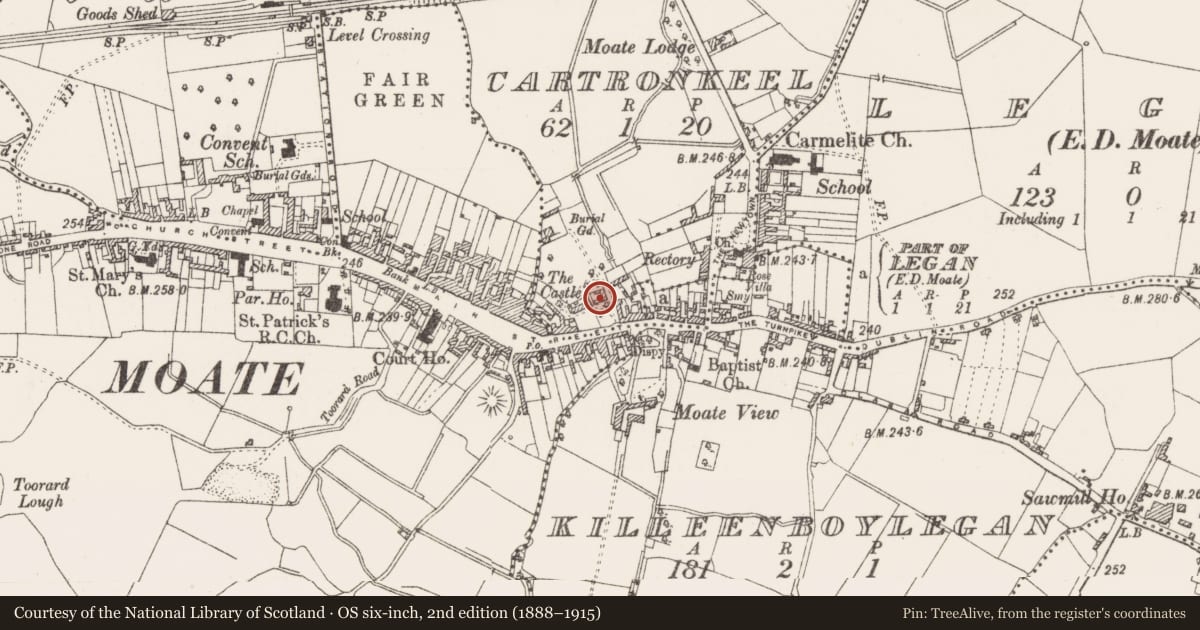
The record
- Townland
- Cartronkeel (Clonlonan By.)
- County
- Westmeath
- Country
- Ireland
- First-edition OS map
- Not indicated
- Latest-edition OS map
- Not indicated
- Coordinates
- 53.39552, -7.71749
- SMR number
- WM030-112002-
Slide toward Today to fade the historical sheet and see the modern map underneath.
David Rumsey Map Collection, Stanford LibrariesDavid Rumsey Map Collection, Stanford LibrariesDavid Rumsey Map Collection, Stanford LibrariesDavid Rumsey Map Collection, Stanford Libraries
4 historical maps cover this location, the earliest the 1790 map "Composite: Ireland." (David Rumsey Map Collection, Stanford Libraries).
Historical maps covering this location
- 1790 · Composite: Ireland. (David Rumsey Map Collection, Stanford Libraries)
- 1811 · Ireland. (David Rumsey Map Collection, Stanford Libraries)
- 1869 · Ireland. (David Rumsey Map Collection, Stanford Libraries)
- 1891 · Ireland 16 (David Rumsey Map Collection, Stanford Libraries)
This record in the National Monuments Service's Historic Environment Viewer ↗
The National Monuments Service's description
Incorporated into the small yard to the East of Moate Castle (WM030-112----) is a fine medieval doorway with a sheela-na-gig (WM030-112001-) above it. In the outer wall of the 18th c. stables in the yard is a small single light ogee headed window and a fine cut-stone triskele ventilator, both of 15th or 16th century style. These architectural features may have originally belonged to the fabric of the medieval castle and may have been moved when the Georgian House was added on to the medieval tower house.
Compiled by Alison McQueen, Vera Rahilly and Caimin O’Brien.
Date of upload: 11 November 2019
Nearby in the register
- Sheela-na-gigunder 1 mi
- Castle - tower houseunder 1 mi
- Bawnunder 1 mi
- Meeting-houseunder 1 mi
Other entries of the same register within about three miles of this one, by straight line.