Sites and Monuments Record · Ireland
Graveyard
Knockmant, County Westmeath, Ireland
The record
- Townland
- Knockmant
- County
- Westmeath
- Country
- Ireland
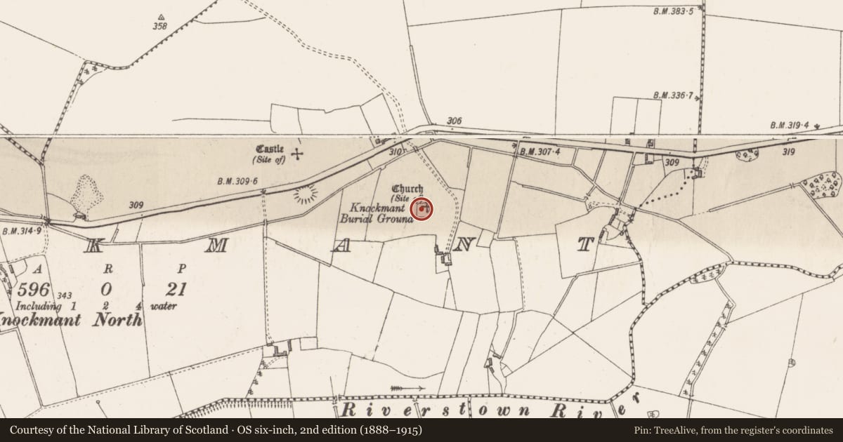
- First-edition OS map
- Knockmant Burial Ground
- Latest-edition OS map
- Knockmant Burial Ground
- Coordinates
- 53.50616, -7.19006
- SMR number
- WM027-009002-
Slide toward Today to fade the historical sheet and see the modern map underneath.
David Rumsey Map Collection, Stanford LibrariesDavid Rumsey Map Collection, Stanford LibrariesDavid Rumsey Map Collection, Stanford LibrariesDavid Rumsey Map Collection, Stanford Libraries
4 historical maps cover this location, the earliest the 1790 map "Composite: Ireland." (David Rumsey Map Collection, Stanford Libraries).
Historical maps covering this location
- 1790 · Composite: Ireland. (David Rumsey Map Collection, Stanford Libraries)
- 1811 · Ireland. (David Rumsey Map Collection, Stanford Libraries)
- 1869 · Ireland. (David Rumsey Map Collection, Stanford Libraries)
- 1891 · Ireland 16 (David Rumsey Map Collection, Stanford Libraries)
This record in the National Monuments Service's Historic Environment Viewer ↗
The National Monuments Service's description
On top of low hillock with good views in all directions. Castle site (WM027-007001-) 255m to NW and ringfort (WM027-008----) 210m to WNW. Souterrain (WM027-009003-) c. 30m to SW. Modern quarry area located to SW-W and N of church. Depicted on 1837 ed. OS 6-inch map as ‘Knockmant Burial Ground’ with church (WM027-009001-) shown forming the N boundary of ‘small rectangular shaped graveyard the enclosing element of which is shown in dotted outline. The graveyard today consists of a rectangular area (dims. c. 29m N-S; 26m E-W) enclosed by a stone wall of post-1700 date. Memorials date from 18th and 19th centuries. Church and graveyard located on top of hillock the base of which has been scarped forming an enclosing element which has the appearance of a possible ecclesiastical enclosure. A series of sub-dividing banks within this enclosure forming small square-shaped fields can be seen on B/W aerial photographs (APE 20, 21, 24).
Compiled by: Caimin O’Brien
Date of upload: 15 August 2013
Nearby in the register
- Churchunder 1 mi
- Souterrainunder 1 mi
- Ringfort - rathunder 1 mi
- Castle - unclassifiedunder 1 mi
Other entries of the same register within about three miles of this one, by straight line.