Sites and Monuments Record · Ireland
Ringfort - rath
Vilanstown, County Westmeath, Ireland
The record
- Townland
- Vilanstown
- County
- Westmeath
- Country
- Ireland
- First-edition OS map
- Hachured
- Latest-edition OS map
- Hachured
- Coordinates
- 53.47634, -7.28347
- SMR number
- WM026-074----
Slide toward Today to fade the historical sheet and see the modern map underneath.
David Rumsey Map Collection, Stanford LibrariesDavid Rumsey Map Collection, Stanford LibrariesDavid Rumsey Map Collection, Stanford LibrariesDavid Rumsey Map Collection, Stanford Libraries
4 historical maps cover this location, the earliest the 1790 map "Composite: Ireland." (David Rumsey Map Collection, Stanford Libraries).
Historical maps covering this location
- 1790 · Composite: Ireland. (David Rumsey Map Collection, Stanford Libraries)
- 1811 · Ireland. (David Rumsey Map Collection, Stanford Libraries)
- 1869 · Ireland. (David Rumsey Map Collection, Stanford Libraries)
- 1891 · Ireland 16 (David Rumsey Map Collection, Stanford Libraries)
This record in the National Monuments Service's Historic Environment Viewer ↗
The National Monuments Service's description
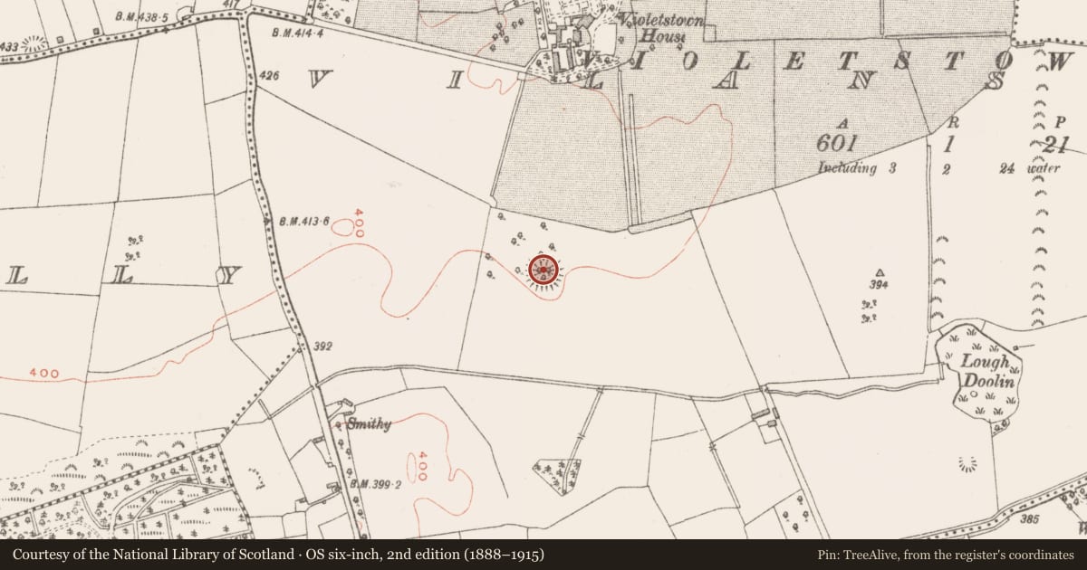
Situated on flat grassland in SE corner of 18th/19th century ornamental woodland plantation associated with Violetstown House located 300m to N. This monument is an example of a ringfort reused as a tree-ring in the 18th/19th century as part of the landscaping of the demesne lands of Violetstown House. The ringfort stood in the SE corner of small square shaped woodland plantation (dims. 95m N-S; 120m E-W) consisting of oak, beech and chestnut.
Present remains consist of a well preserved circular-shaped area (diam. 37m E-W) defined by an earth and stone bank with external fosse and traces of an outer bank. The interior has been planted with oak trees. No clear entrance feature visible. A fosse running N-S intersects the SE side of the monument with a second fosse running E-W intersecting the site at S, both of which are boundary ditches associated with the post-1700 woodland plantation.
See attached profile of monument surveyed and drawn by the ASI.
Compiled by: Caimin O'Brien
Date of upload: 30 August 2018
Nearby in the register
- Penal Mass stationunder 1 mi
- Ringfort - rathunder 1 mi
- Barrow - unclassifiedunder 1 mi
- Ringfort - rathunder 1 mi
Other entries of the same register within about three miles of this one, by straight line.