Sites and Monuments Record · Ireland
Graveyard
Lynn, County Westmeath, Ireland
The record
- Townland
- Lynn
- County
- Westmeath
- Country
- Ireland
- First-edition OS map
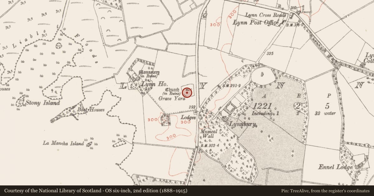
- Grave Yard
- Latest-edition OS map
- Grave Yard
- Coordinates
- 53.49485, -7.36053
- SMR number
- WM026-003001-
Slide toward Today to fade the historical sheet and see the modern map underneath.
David Rumsey Map Collection, Stanford LibrariesDavid Rumsey Map Collection, Stanford LibrariesDavid Rumsey Map Collection, Stanford LibrariesDavid Rumsey Map Collection, Stanford Libraries
4 historical maps cover this location, the earliest the 1790 map "Composite: Ireland." (David Rumsey Map Collection, Stanford Libraries).
Historical maps covering this location
- 1790 · Composite: Ireland. (David Rumsey Map Collection, Stanford Libraries)
- 1811 · Ireland. (David Rumsey Map Collection, Stanford Libraries)
- 1869 · Ireland. (David Rumsey Map Collection, Stanford Libraries)
- 1891 · Ireland 16 (David Rumsey Map Collection, Stanford Libraries)
This record in the National Monuments Service's Historic Environment Viewer ↗
The National Monuments Service's description
Situated on N facing slope of low rising ground with Lynn House and Lough Ennell 190m and 290m to W respectively. Mullingar town lies 3.4km to N. A sub-triangular shaped area (approx. dims. 57m E-W x 54m N-S) enclosed by a stone wall of post-1700 date entered through a gate and stile at S end of E wall. Straight sided wall at N and E with curving graveyard wall from S to W which may follow line of Early Christian ecclesiastical enclosure (Swan 1988, 13). Medieval parish church (WM026-003----) of Lynn lies in N quadrant of graveyard. Memorials date from 18th and 19th century and are mainly located to the E, S and W of the church. The graveyard wall has been broken down in several places due to root disturbance of the trees planted around the perimeter of the graveyard.
Compiled by: Caimin O'Brien
Date of upload: 12 December 2017
References
Swan, D.L. 1988 The Early Christian ecclesiastical sites of County Westmeath. In J. Bradley (ed.), Settlement and society in Medieval Ireland: studies presented to F.X. Martin O.S.A., 1-31. Kilkenny. Boethius Press.
Nearby in the register
- Ecclesiastical enclosureunder 1 mi
- Fontunder 1 mi
- Churchunder 1 mi
- Burial groundunder 1 mi
Other entries of the same register within about three miles of this one, by straight line.