Sites and Monuments Record · Ireland
Castle - ringwork
Duneel, County Westmeath, Ireland
The record
- Townland
- Duneel
- County
- Westmeath
- Country
- Ireland
- First-edition OS map
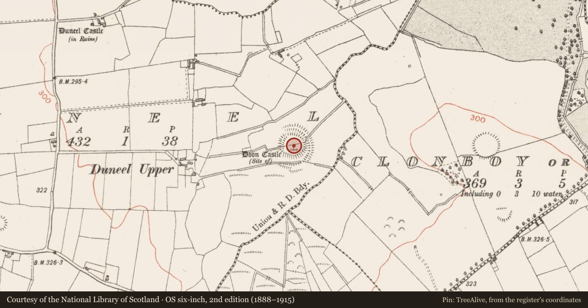
- Site of Doon Castle
- Latest-edition OS map
- Doon Castle (Site of)
- Coordinates
- 53.50189, -7.62548
- SMR number
- WM024-010----
Slide toward Today to fade the historical sheet and see the modern map underneath.
David Rumsey Map Collection, Stanford LibrariesDavid Rumsey Map Collection, Stanford LibrariesDavid Rumsey Map Collection, Stanford LibrariesDavid Rumsey Map Collection, Stanford Libraries
4 historical maps cover this location, the earliest the 1790 map "Composite: Ireland." (David Rumsey Map Collection, Stanford Libraries).
Historical maps covering this location
- 1790 · Composite: Ireland. (David Rumsey Map Collection, Stanford Libraries)
- 1811 · Ireland. (David Rumsey Map Collection, Stanford Libraries)
- 1869 · Ireland. (David Rumsey Map Collection, Stanford Libraries)
- 1891 · Ireland 16 (David Rumsey Map Collection, Stanford Libraries)
This record in the National Monuments Service's Historic Environment Viewer ↗
The National Monuments Service's description
Situated on a slight natural rise, in low-lying wet pasture. Bivallate ringwork described in 1971 as a roughly circular-shaped area enclosed by an inner bank, an intervening fosse, an outer bank and an external fosse with entrance gap at SE . The earthen banks are both large and widely spaced with the slight remains of a fosse outside each. Both banks are gapped in places and the ground is disturbed by quarrying outside the inner bank at SE. The monument is bisected by a modern field fence running ENE-WSW. The site of Doon Castle (WM024-010001-) is located within the S half of the interior. Circular ringwork appears to form the bawn or courtyard of Doon Castle. Outline of monument clearly visible on oblique aerial photographs (CUCAP AOY093/094)taken 12/07/1966.
Compiled by Alison McQueen, Vera Rahilly and Caimin O’Brien.
Date of upload: 30 July 2019
References
CUCAP - Cambridge University Collection of Aerial Photographs. Unit for Landscape Modelling, Department of Geography, University of Cambridge. See:https://www.cambridgeairphotos.com
Nearby in the register
- Castle - unclassifiedunder 1 mi
- Enclosure - large enclosureunder 1 mi
- Ringfort - rathunder 1 mi
- Ringfort - rathunder 1 mi
Other entries of the same register within about three miles of this one, by straight line.