Sites and Monuments Record · Ireland
Ritual site - holy well
Cartroncoragh, County Westmeath, Ireland
The record
- Townland
- Cartroncoragh
- County
- Westmeath
- Country
- Ireland
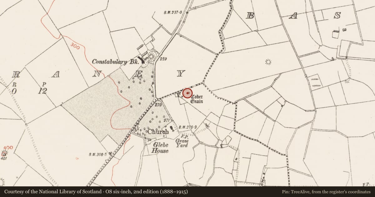
- First-edition OS map
- Tober Enain
- Latest-edition OS map
- Tober Enain
- Coordinates
- 53.48724, -7.74049
- SMR number
- WM023-039----
Slide toward Today to fade the historical sheet and see the modern map underneath.
David Rumsey Map Collection, Stanford LibrariesDavid Rumsey Map Collection, Stanford LibrariesDavid Rumsey Map Collection, Stanford LibrariesDavid Rumsey Map Collection, Stanford Libraries
4 historical maps cover this location, the earliest the 1790 map "Composite: Ireland." (David Rumsey Map Collection, Stanford Libraries).
Historical maps covering this location
- 1790 · Composite: Ireland. (David Rumsey Map Collection, Stanford Libraries)
- 1811 · Ireland. (David Rumsey Map Collection, Stanford Libraries)
- 1869 · Ireland. (David Rumsey Map Collection, Stanford Libraries)
- 1891 · Ireland 16 (David Rumsey Map Collection, Stanford Libraries)
This record in the National Monuments Service's Historic Environment Viewer ↗
The National Monuments Service's description
Situated on flat poorly drained land with artificial lake to S. Drumraney church (WM023-040----) and graveyard 150m to SW, Drumraney Castle (WM023-036----) 220m to NW. Holy well dedicated to St Éanán of Drumraney whose feastday is celebrated on the 19th of August and 18th of September (Ó Riain 2011, 657-8). In 1837 its recorded that this was 'a holy well, dedicated to St. Enan; his festival is celebrated on the Sunday after Sept. 18th’ (Lewis 1837, 520). In 1981 it was recorded that the well was subject to local veneration and according to a local woman who stated that the water from well would ‘work miraculous cures if you had the belief’ (SMR File 14/10/1981). Present remains consist of a large ash tree standing over a natural spring well faced by a drystone wall with steps leading down to water. The well appears to be standing inside a small circular enclosure defined a low stone wall as depicted on the OS 25-inch map.
Compiled by: Caimin O'Brien
Date of upload: 6 July 2015
References
Ó Riain, P. 2011 A dictionary of Irish Saints. Dublin. Four Courts Press.
Lewis, S. 1837 A topographical dictionary of Ireland, 2 vols. London. Lewis and Co.
Nearby in the register
Other entries of the same register within about three miles of this one, by straight line.