Sites and Monuments Record · Ireland
Architectural fragment
Kilkenny West, County Westmeath, Ireland
The record
- Townland
- Kilkenny West
- County
- Westmeath
- Country
- Ireland
- First-edition OS map
- Not indicated
- Latest-edition OS map
- Not indicated
- Coordinates
- 53.49057, -7.81188
- SMR number
- WM023-024003-
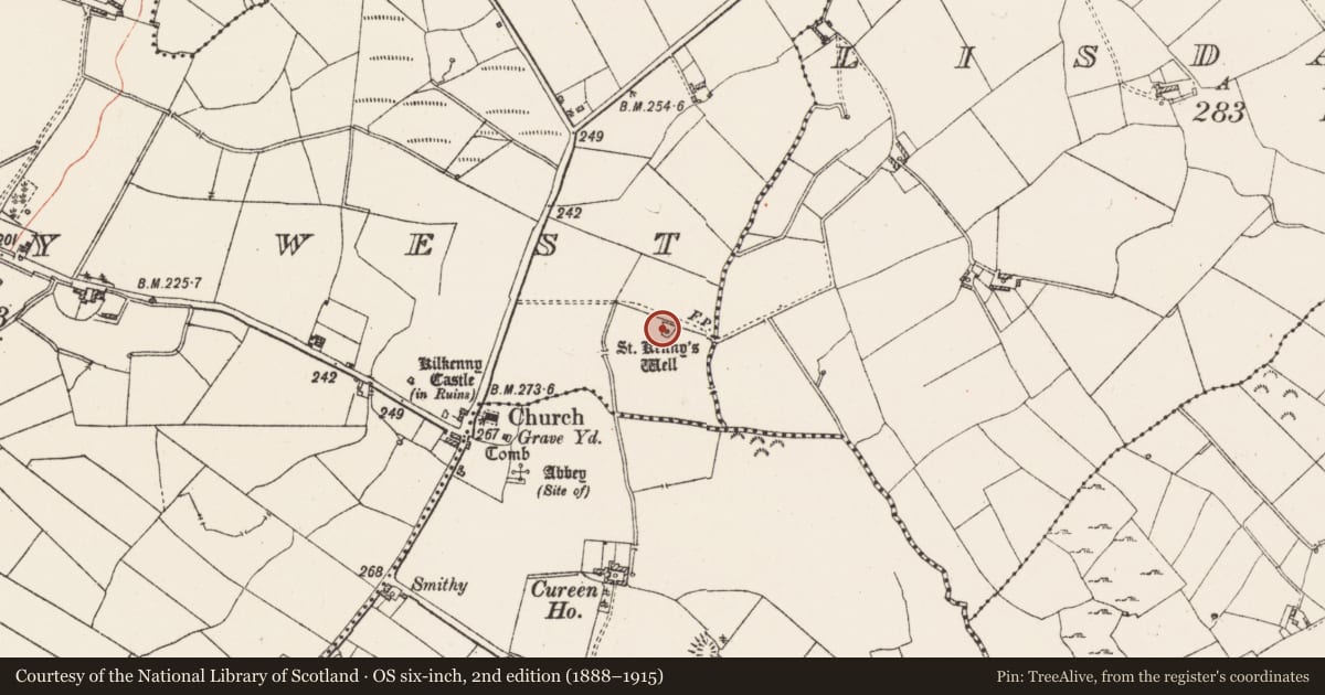
Slide toward Today to fade the historical sheet and see the modern map underneath.
David Rumsey Map Collection, Stanford LibrariesDavid Rumsey Map Collection, Stanford LibrariesDavid Rumsey Map Collection, Stanford LibrariesDavid Rumsey Map Collection, Stanford Libraries
4 historical maps cover this location, the earliest the 1790 map "Composite: Ireland." (David Rumsey Map Collection, Stanford Libraries).
Historical maps covering this location
- 1790 · Composite: Ireland. (David Rumsey Map Collection, Stanford Libraries)
- 1811 · Ireland. (David Rumsey Map Collection, Stanford Libraries)
- 1869 · Ireland. (David Rumsey Map Collection, Stanford Libraries)
- 1891 · Ireland 16 (David Rumsey Map Collection, Stanford Libraries)
This record in the National Monuments Service's Historic Environment Viewer ↗
The National Monuments Service's description
St. Kenny's [St. Canice] holy well (WM023-024----) situated in a roughly-D-shaped grove of trees and bushes on flat poorly drained land with church (WM023-025----) and graveyard (WM023-025001-) 240m to SW. Kilkenny Castle (WM023-023----) 330m to WSW and site of levelled abbey (WM023-026----) belonging to the Fratres Cruciferi / Crouched Friars 260m to SSW. A large octagonal-shaped font (WM023-024001-) lies on the ground immediately to the N of well. This font may have come from the medieval church (WM023-025----) or from the abbey site (WM023-026----). Other architectural fragments of various dates have been placed around the perimeter of the well forming a series of stations around the well. The hexagonal shaped base of a cross or font lies to the W of the well, a stone cross (WM023-024002-) possibly a finial cross of the medieval church (WM023-025----) has been placed into the socket of this base. The carving of a winged angel can be seen on a V-shaped architectural fragment which formed the apex of a niche or apex of a hood moulding lying on the ground immediately SE of the well. This fragment came from either the medieval abbey (WM023-026---) or the nearby medieval church (WM023-025----). Immediately to the NNE of the well lying on the surface of the ground there is a large piece of cut stone which appears to be the capital (WM023-024004-) of a column supporting the ribs of a vaulted roof belonging to the nearby medieval abbey (WM023-026---). Unable to locate stone corbel carved with an angel which was recorded in the late 1970s (SMR File). A stone fleur-de-lys cross of post medieval date with socket for metal cross stands immediately SE of the well.
Compiled by: Caimin O'Brien
Date of upload: 3 July 2015
Nearby in the register
- Ritual site - holy wellunder 1 mi
- Font (present location)under 1 mi
- Crossunder 1 mi
- Architectural fragmentunder 1 mi
Other entries of the same register within about three miles of this one, by straight line.