Sites and Monuments Record · Ireland
Religious house - unclassified
Balroe, County Westmeath, Ireland
The record
- Townland
- Balroe
- County
- Westmeath
- Country
- Ireland
- First-edition OS map
- Nunnery
- Latest-edition OS map
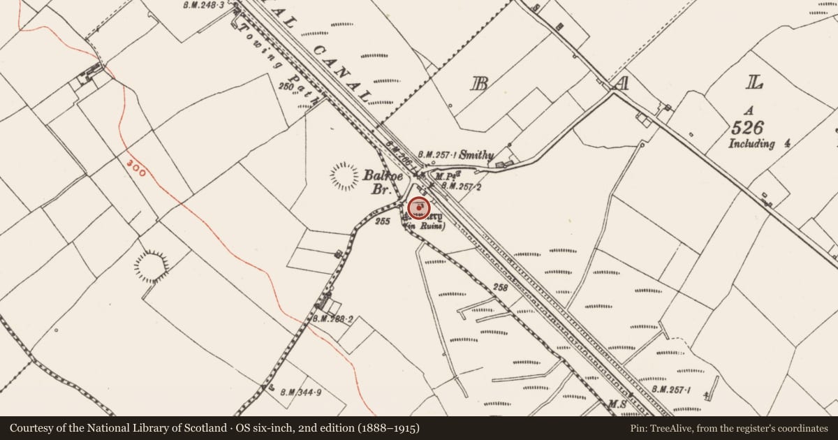
- Nunnery (in Ruins)
- Coordinates
- 53.56963, -7.51718
- SMR number
- WM011-121----
Slide toward Today to fade the historical sheet and see the modern map underneath.
David Rumsey Map Collection, Stanford LibrariesDavid Rumsey Map Collection, Stanford LibrariesDavid Rumsey Map Collection, Stanford LibrariesDavid Rumsey Map Collection, Stanford Libraries
4 historical maps cover this location, the earliest the 1790 map "Composite: Ireland." (David Rumsey Map Collection, Stanford Libraries).
Historical maps covering this location
- 1790 · Composite: Ireland. (David Rumsey Map Collection, Stanford Libraries)
- 1811 · Ireland. (David Rumsey Map Collection, Stanford Libraries)
- 1869 · Ireland. (David Rumsey Map Collection, Stanford Libraries)
- 1891 · Ireland 16 (David Rumsey Map Collection, Stanford Libraries)
This record in the National Monuments Service's Historic Environment Viewer ↗
The National Monuments Service's description
Situated on low-lying undulating grassland, 30m E of Balroe Bridge. Ringfort (WM011-119---) 135m to NW. Laragh Castle (WM011-120----) 200m to SW. Ringfort (WM011-122---) 75m to NE. The Royal canal is 50m to E with stream immediately to W. Depicted as a rectnaguar shaped building aligned E-W on the 1837 ed. OS 6-inch map and annotated as a ‘Nunnery’. On the revised 1911 ed. OS 25-inch map only the E gable of the 'Nunnery' is depicted as upstanding suggesting that most of the building was levelled between these two dates. In 1978 the site was described as consisting of a rectangular shaped area defined by grass-covered wall footings (approx. diam 6m N-S; 16m E-W). An ASI site report from 1980 recorded that this site has been levelled, with pieces of masonry lying against a nearby field fence. A farm road now crosses the site which is visible on Digital Globe aerial photograph taken November 2011.
Compiled by: Frank Coyne and Caimin O'Brien
Date of upload: 28 August 2017
Nearby in the register
- Ringfort - rathunder 1 mi
- Ringfort - rathunder 1 mi
- Castle - tower houseunder 1 mi
- Ringfort - rathunder 1 mi
Other entries of the same register within about three miles of this one, by straight line.