Sites and Monuments Record · Ireland
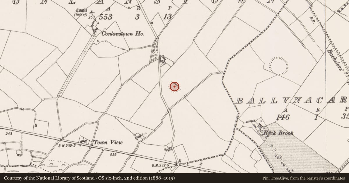
Ringfort - unclassified
Conlanstown, County Westmeath, Ireland
The record
- Townland
- Conlanstown
- County
- Westmeath
- Country
- Ireland
- First-edition OS map
- Hachured
- Latest-edition OS map
- Hachured
- Coordinates
- 53.58852, -7.54888
- SMR number
- WM010-014----
Slide toward Today to fade the historical sheet and see the modern map underneath.
David Rumsey Map Collection, Stanford LibrariesDavid Rumsey Map Collection, Stanford LibrariesDavid Rumsey Map Collection, Stanford LibrariesDavid Rumsey Map Collection, Stanford Libraries
4 historical maps cover this location, the earliest the 1790 map "Composite: Ireland." (David Rumsey Map Collection, Stanford Libraries).
Historical maps covering this location
- 1790 · Composite: Ireland. (David Rumsey Map Collection, Stanford Libraries)
- 1811 · Ireland. (David Rumsey Map Collection, Stanford Libraries)
- 1869 · Ireland. (David Rumsey Map Collection, Stanford Libraries)
- 1891 · Ireland 16 (David Rumsey Map Collection, Stanford Libraries)
This record in the National Monuments Service's Historic Environment Viewer ↗
The National Monuments Service's description
Depicted as a circular enclosure with trees on perimeter on the 1837 OS Fair Plan map, annotated ‘Rathmore’, with a gravel pit outside bank at SE. Depicted as a circular-shaped monument with roadway running SE from SE edge of monument. Possible ringfort re-used as a tree-ring in the post 1700 period. Conlanstown House located 445m to NW. Present remains consist of an elongated oval-shaped area (approx. diam. 33m NNW-SSE; 19m ENE-WSW) enclosed by a poorly preserved earthen bank. The bank is fragmentary, and there is a possible entrance gap (Wth 1.1m) at NNW. Just inside the bank in the E quadrant of the interior are four large stone slabs, two set on edge side by side, and one lying flat with the fourth lying against it. To the E of the centre is another large grass-covered slab. There are several tree trunks in the interior, possibly as the result of the site being reused as a tree ring. There is a large depression at the ESE side of the monument, probably the result of quarrying.
Compiled by: Frank Coyne and Caimin O'Brien
Date of upload: 8 June 2017
Nearby in the register
- Ringfort - rathunder 1 mi
- Castle - unclassifiedunder 1 mi
- Barrow - mound barrowunder 1 mi
- Barrow - mound barrowunder 1 mi
Other entries of the same register within about three miles of this one, by straight line.