Sites and Monuments Record · Ireland
Designed landscape feature
Killua, County Westmeath, Ireland
The record
- Townland
- Killua
- County
- Westmeath
- Country
- Ireland
- First-edition OS map
- Not indicated
- Latest-edition OS map
- Not indicated
- Coordinates
- 53.65763, -7.00178
- SMR number
- WM009-011----
Slide toward Today to fade the historical sheet and see the modern map underneath.
David Rumsey Map Collection, Stanford LibrariesDavid Rumsey Map Collection, Stanford LibrariesDavid Rumsey Map Collection, Stanford LibrariesDavid Rumsey Map Collection, Stanford Libraries
4 historical maps cover this location, the earliest the 1790 map "Composite: Ireland." (David Rumsey Map Collection, Stanford Libraries).
Historical maps covering this location
- 1790 · Composite: Ireland. (David Rumsey Map Collection, Stanford Libraries)
- 1811 · Ireland. (David Rumsey Map Collection, Stanford Libraries)
- 1869 · Ireland. (David Rumsey Map Collection, Stanford Libraries)
- 1891 · Ireland 16 (David Rumsey Map Collection, Stanford Libraries)
This record in the National Monuments Service's Historic Environment Viewer ↗
The National Monuments Service's description
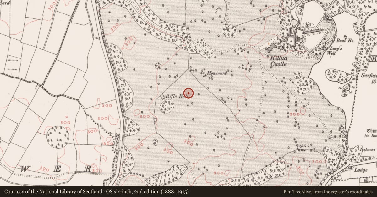
Situated on NE facing slope of a natural rise in the Deerpark of Killua Castle demesne. Killua Castle 410m to NNE. Similar designed landscape feature (WM009-009---) 45m to SSE and possible ringfort (WM09-010----) 65m to SW. A folly depicted on the 1837 ed. OS 6-inch map as 'Monument' in Gothic script is located 120m to NE. A small circular shaped earthen mound (diam. 10m; H 1m) defined by a scarp and narrow fosse with evidence of post-1700 quarrying at the foot of the mound at SW. There is a slight depression in the top of the mound and there are a number of tree stumps on it. Could be the remains of a designed landscape feature tree ring on the demesne lands of Killua Castle. The cropmark of five similar designed landscape earthworks 70m to S can be seen running in a line from W-E on Digital Globe aerial photograph taken November 2011.
See attached section of monument surveyed and drawn by the ASI.
Compiled by: Frank Coyne and Caimin O'Brien
Date of upload: 28 April 2017
Nearby in the register
- Designed landscape featureunder 1 mi
- Ringfort - rathunder 1 mi
- Barrow - unclassifiedunder 1 mi
- Barrow - unclassifiedunder 1 mi
Other entries of the same register within about three miles of this one, by straight line.