Sites and Monuments Record · Ireland
Barrow - ring-barrow
Knockloe, County Wicklow, Ireland
The record
- Townland
- Knockloe
- County
- Wicklow
- Country
- Ireland
- First-edition OS map
- Not indicated
- Latest-edition OS map
- Not indicated
- Coordinates
- 52.80620, -6.68356
- SMR number
- WI037-029001-
Slide toward Today to fade the historical sheet and see the modern map underneath.
David Rumsey Map Collection, Stanford LibrariesDavid Rumsey Map Collection, Stanford LibrariesDavid Rumsey Map Collection, Stanford LibrariesDavid Rumsey Map Collection, Stanford Libraries
4 historical maps cover this location, the earliest the 1790 map "Composite: Ireland." (David Rumsey Map Collection, Stanford Libraries).
Historical maps covering this location
- 1790 · Composite: Ireland. (David Rumsey Map Collection, Stanford Libraries)
- 1799 · Ireland. (David Rumsey Map Collection, Stanford Libraries)
- 1830 · V.3:11-15:XV. Britisches Reich. C. Kon: Ireland. a. Prov: Leinster. Counties: 1-12 (David Rumsey Map Collection, Stanford Libraries)
- 1891 · Ireland 16 (David Rumsey Map Collection, Stanford Libraries)
This record in the National Monuments Service's Historic Environment Viewer ↗
The National Monuments Service's description
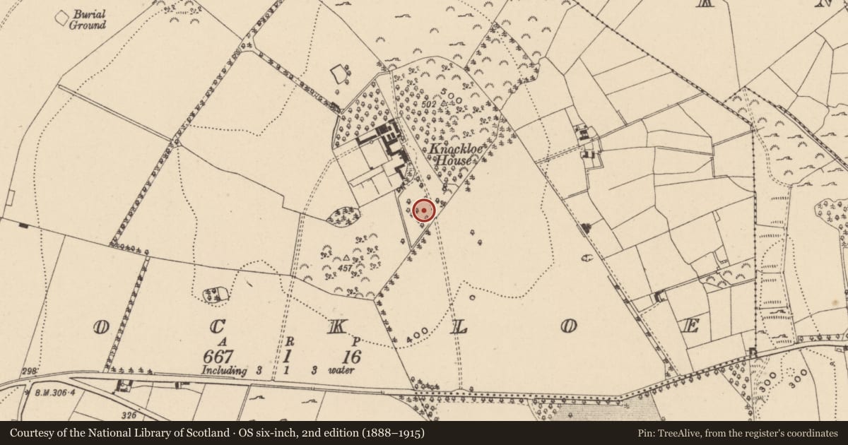
Situated on flat grassland immediately N of Knockloe House and to the W of the driveway leading up to the abandoned ruins of this country house. One of a group of 5 possible barrows (WI037-029001-/005-) clustered in a small field (dims. 59m NE-SW; 110m N-S) clearly visible on Digital Globe aerial photograph taken November 2011. Site consists of a low circular mound (approx. diam. 8m) enclosed by a wide shallow fosse (Wth 2m; D 0.2m) with traces of an external bank (Wth 2m; ext. H 0.1m) in SE quadrant of field adjacent to driveway leading up to Knockloe House. According to landowner this field was used to 'ring horses' in the 19th century. Visible as a cropmark on the 2005 OSI aerial photograph, on this photograph the earthwork (WI037-029005-) in the N quadrant of the field appears to be the formed by a circular feeding trough. The clustering of these earthworks in a small narrow field and their preservation along with their close proximity to Knockloe House may cast doubts on their antiquity.
Compiled by: Caimin O'Brien based on details kindly provided by Dr. Charles Mount.
Date of upload: 9 February 2017
Nearby in the register
- Barrow - ring-barrowunder 1 mi
- Barrow - ring-barrowunder 1 mi
- Barrow - ring-barrowunder 1 mi
- Barrow - ring-barrowunder 1 mi
Other entries of the same register within about three miles of this one, by straight line.