Sites and Monuments Record · Ireland
Church
Bahana (Newcastle By.), County Wicklow, Ireland
The record
- Townland
- Bahana (Newcastle By.)
- County
- Wicklow
- Country
- Ireland
- Latest-edition OS map
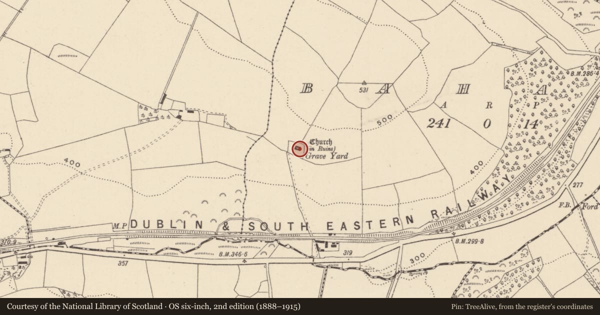
- Church (in Ruins), Grave Yard
- Coordinates
- 52.94326, -6.19710
- SMR number
- WI030-007----
Slide toward Today to fade the historical sheet and see the modern map underneath.
David Rumsey Map Collection, Stanford LibrariesDavid Rumsey Map Collection, Stanford LibrariesDavid Rumsey Map Collection, Stanford LibrariesDavid Rumsey Map Collection, Stanford Libraries
4 historical maps cover this location, the earliest the 1799 map "Ireland." (David Rumsey Map Collection, Stanford Libraries).
Historical maps covering this location
- 1799 · Ireland. (David Rumsey Map Collection, Stanford Libraries)
- 1811 · Ireland. (David Rumsey Map Collection, Stanford Libraries)
- 1841 · Ireland. (David Rumsey Map Collection, Stanford Libraries)
- 1891 · Ireland 16 (David Rumsey Map Collection, Stanford Libraries)
This record in the National Monuments Service's Historic Environment Viewer ↗
The National Monuments Service's description
Situated on a marked S-facing slope overlooking a valley. This is the parish church of Kilcommon, recorded in Irish sources as Cille Commáin and Gill Comain (Pers Com. Conchubhar Ó Crualaoich). A nave and chancel church (dims. 12.1m E-W x 6.3m N-S) of uncoursed mortared rubble. The walls are represented by collapsed rubble (T 0.9-1.1m; H 0.4-0.6m) apart from the E gable (H 5.4m) which is still standing. No trace of a doorway. The E gable has an incomplete central window with chamfered granite jambs and a wall niche at the SE angle. The church is towards the E end of a quadrangular graveyard (dims. 45m WNW-ESE; 40m at the E - 30m at the W) defined by a collapsed earth and stone bank (Wth 2m), and a slight outer fosse at the N and E (Wth 1.8m). There are several mid-eighteenth-century graveslabs in the church.
The above description is derived from the published 'Archaeological Inventory of County Wicklow' (Dublin: Stationery Office, 1997). In certain instances the entries have been revised and updated in the light of recent research.
Date of upload/revision: 17 December 2008
Nearby in the register
- Graveyardunder 1 mi
- Ringfort - unclassifiedunder 1 mi
- Enclosureunder 1 mi
- Enclosure1 mi
Other entries of the same register within about three miles of this one, by straight line.