Sites and Monuments Record · Ireland
Castle - unclassified
Milltown North, County Wicklow, Ireland
The record
- Townland
- Milltown North
- County
- Wicklow
- Country
- Ireland
- First-edition OS map
- Not indicated
- Latest-edition OS map
- Not indicated
- Coordinates
- 52.99505, -6.10223
- SMR number
- WI025-035----
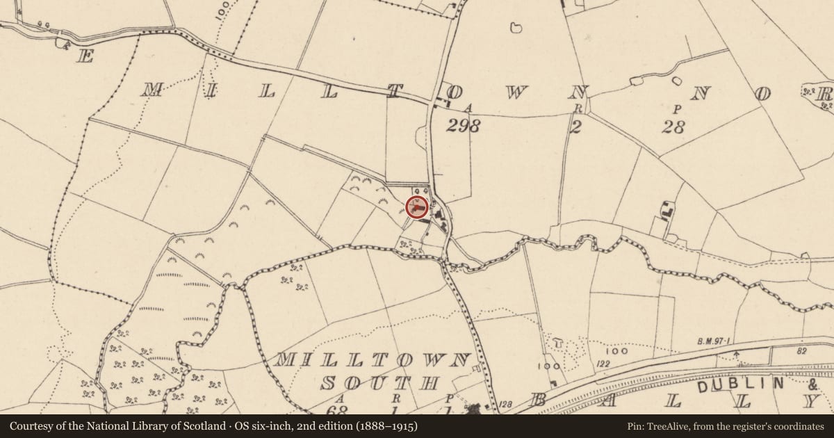
Slide toward Today to fade the historical sheet and see the modern map underneath.
David Rumsey Map Collection, Stanford LibrariesDavid Rumsey Map Collection, Stanford LibrariesDavid Rumsey Map Collection, Stanford LibrariesDavid Rumsey Map Collection, Stanford Libraries
4 historical maps cover this location, the earliest the 1799 map "Ireland." (David Rumsey Map Collection, Stanford Libraries).
Historical maps covering this location
- 1799 · Ireland. (David Rumsey Map Collection, Stanford Libraries)
- 1811 · Ireland. (David Rumsey Map Collection, Stanford Libraries)
- 1841 · Ireland. (David Rumsey Map Collection, Stanford Libraries)
- 1891 · Ireland 16 (David Rumsey Map Collection, Stanford Libraries)
This record in the National Monuments Service's Historic Environment Viewer ↗
The National Monuments Service's description
'Milltown castle, as it is called, stands in the townland of Milltown; measuring sixty-six feet in length by eighteen in breadth. The east end, about twenty six feet high remains, with a breach extending from the top half down, and the south wall remains entire to the height of about eighteen feet. The north wall and west gable are down. There is a round tower at the south west angle, nine feet diameter, the walls three feet thick and about twenty eight feet high, having six loopholes, with a window on the south side about six feet high, two feet broad and fifteen feet from the ground.' (OS Letters, 250).
There is a round tower at the south west angle, nine feet diameter, the walls three feet thick and about twenty eight feet high, having six loopholes, with a window on the south side about six feet high, two feet broad and fifteen feet from the ground. This cannot be one of the Anglo Norman castle but one of the Elizabethan houses probably" (Corlett & Medlycott 2001, 79).
Date of upload: 22 October 2012
References
Corlett, C. and Medleycott, J. (eds.) 2000 The Ordnance Survey Letters Wicklow. Wicklow. Roundwood & District Historical & Folklore Society.
Nearby in the register
- Burnt moundunder 1 mi
- Excavation - miscellaneousunder 1 mi
- Ring-ditchunder 1 mi
- Ring-ditchunder 1 mi
Other entries of the same register within about three miles of this one, by straight line.