Sites and Monuments Record · Ireland
Water mill - vertical-wheeled
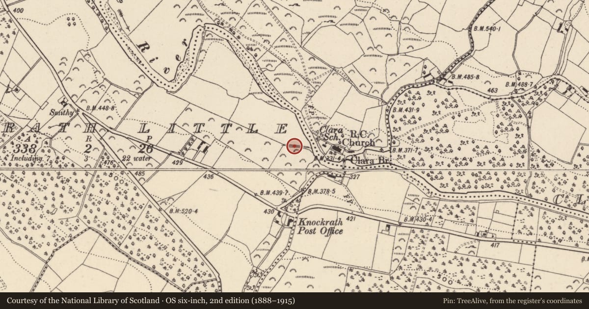
Knockrath Little, County Wicklow, Ireland
The record
- Townland
- Knockrath Little
- County
- Wicklow
- Country
- Ireland
- First-edition OS map
- Not indicated
- Latest-edition OS map
- Not indicated
- Coordinates
- 52.96775, -6.26296
- SMR number
- WI024-040----
Slide toward Today to fade the historical sheet and see the modern map underneath.
David Rumsey Map Collection, Stanford LibrariesDavid Rumsey Map Collection, Stanford LibrariesDavid Rumsey Map Collection, Stanford LibrariesDavid Rumsey Map Collection, Stanford Libraries
4 historical maps cover this location, the earliest the 1799 map "Ireland." (David Rumsey Map Collection, Stanford Libraries).
Historical maps covering this location
- 1799 · Ireland. (David Rumsey Map Collection, Stanford Libraries)
- 1811 · Ireland. (David Rumsey Map Collection, Stanford Libraries)
- 1841 · Ireland. (David Rumsey Map Collection, Stanford Libraries)
- 1891 · Ireland 16 (David Rumsey Map Collection, Stanford Libraries)
This record in the National Monuments Service's Historic Environment Viewer ↗
The National Monuments Service's description
Situated in the valley of the NW-SE Avonmore River, on the SW bank with the stream c. 50m to the NE. Drainage works uncovered a number of dressed timbers and a subsequent archaeological excavation (14E0365) financed by the National Monuments Service recorded the remains of a watermill. An earthen platform (Wth 6.8m E-W) appearing in a section together with the base of its drystone-built N (Wth 1.5m; max. H 0.8m) and S walls supported the mill building, which would have had a wooden superstructure. Portions of the original head-race appeared in sections of the modern drainage together with timbers on the upstream side, suggesting that it had a timber-lined head-race. A large base-beam (L 5m plus; Wth 0.5-0.7m; T 0.3m plus) with mortises on its upper side 27m from the platform could be the dam of a mill-pond. Some post-medieval pottery, late 17th century clay pipes and hand-made bricks were recovered. Fragments of 18 timbers were recorded and re-buried at the location. They consisted largely of base-plates or oak stakes. The remains are interpreted as those of a vertical undershot-wheeled mill, and one of the timbers produced a dendrochronological date of AD 1679 +- 9 years. (Hayden 2014; 2015)
Compiled by: Michael Moore
Date of revised upload: 27 October 2015
References
Hayden, A. 2014 Archaeological evaluation of a site at Knockrath Little, Co. Wicklow.(SMR No. WI024-040----, excavation licence No. 14E0365, detection device licence No. 14R0111) 4th September 2014. Unpublished report for the National Monuments Service, SMR file.
Hayden, A. 2015 A vertical-wheeled watermill at Knockrath Little, Co. Wicklow (WI024-040-----). Excavation licence: 14E0365. Detection device licence: 14R0111. Unpublished report: Archaeological Projects Ltd.
Nearby in the register
- Bullaun stoneunder 1 mi
- Ringfort - rathunder 1 mi
- Castle - tower houseunder 1 mi
- Designed landscape - formal gardenunder 1 mi
Other entries of the same register within about three miles of this one, by straight line.