Sites and Monuments Record · Ireland
Ritual site - holy well
Trooperstown, County Wicklow, Ireland
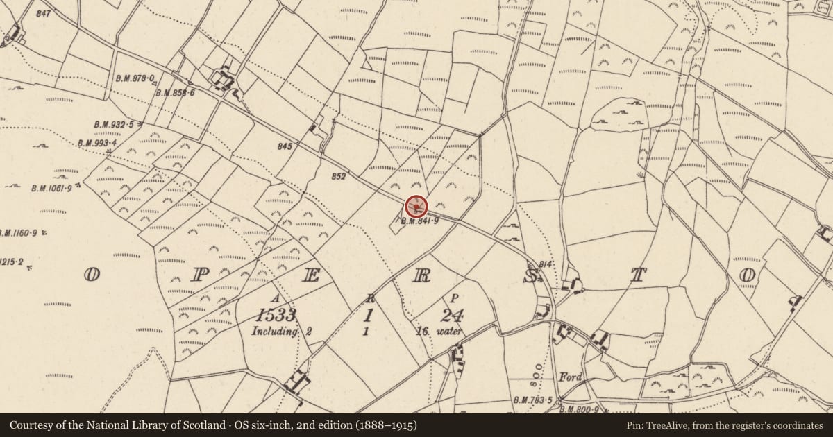
The record
- Townland
- Trooperstown
- County
- Wicklow
- Country
- Ireland
- First-edition OS map
- Not indicated
- Latest-edition OS map
- Outlined
- Coordinates
- 53.00079, -6.24808
- SMR number
- WI024-037----
Slide toward Today to fade the historical sheet and see the modern map underneath.
David Rumsey Map Collection, Stanford LibrariesDavid Rumsey Map Collection, Stanford LibrariesDavid Rumsey Map Collection, Stanford LibrariesDavid Rumsey Map Collection, Stanford Libraries
4 historical maps cover this location, the earliest the 1799 map "Ireland." (David Rumsey Map Collection, Stanford Libraries).
Historical maps covering this location
- 1799 · Ireland. (David Rumsey Map Collection, Stanford Libraries)
- 1811 · Ireland. (David Rumsey Map Collection, Stanford Libraries)
- 1841 · Ireland. (David Rumsey Map Collection, Stanford Libraries)
- 1891 · Ireland 16 (David Rumsey Map Collection, Stanford Libraries)
This record in the National Monuments Service's Historic Environment Viewer ↗
The National Monuments Service's description
According to Lynch (1994, 639) there is a holy well known as ‘Fraughan’s Well’ in the townland of Trooperstown that is mentioned in the 1930s Irish Folklore Commission, Schools Manuscript Collection (IFC S 918: 155; IFC S 1127: 48). The folklore manuscripts recorded the tradition that a ‘holy well near where the priest said Mass in the penal days. Cures for sores and pains. Unlucky to interfere with holy well. The Blessed Virgin said to have been seen at the well’ (Lynch 1994, 639). This well is located beside a mass rock and in the field called ‘Church Field’. A bullaun stone (WI024-027---) is located in a field known as the ‘Church Field’. Holy well located at the side of the road that was named after the Fraughan family who owned the land in the 1800's (pers. comm. Rosaleen Durkin).
Compiled and revised by: Caimin O'Brien based on details provided by Roslaeen Durkin
Date of revised upload: 7 September 2020
References
Lynch, G. 1994 The holy wells of county Wicklow: traditions and legends. In K. Hannigan and W. Nolan (eds), Wicklow history and society, 625-48. Dublin. Geography Publications.
Nearby in the register
- Bullaun stoneunder 1 mi
- Bullaun stoneunder 1 mi
- Ogham stone (present location)under 1 mi
- Enclosureunder 1 mi
Other entries of the same register within about three miles of this one, by straight line.