Sites and Monuments Record · Ireland
Cross-slab
Sevenchurches Or Camaderry, County Wicklow, Ireland
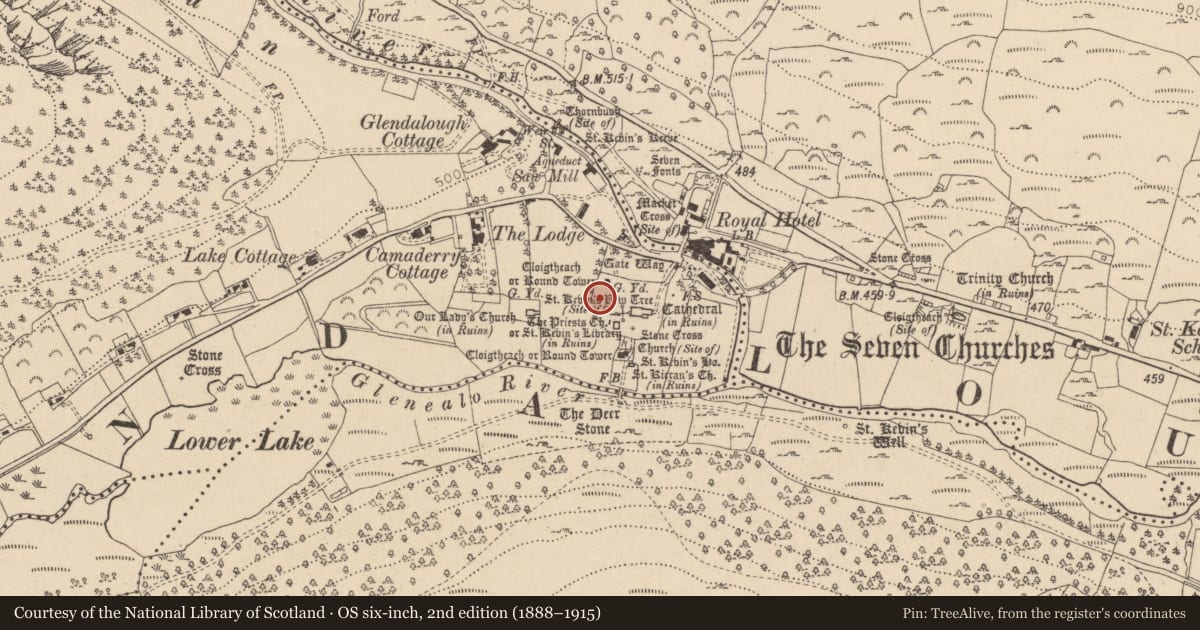
The record
- Townland
- Sevenchurches Or Camaderry
- County
- Wicklow
- Country
- Ireland
- First-edition OS map
- Not indicated
- Latest-edition OS map
- Not indicated
- Coordinates
- 53.01067, -6.32785
- SMR number
- WI023-008053-
Slide toward Today to fade the historical sheet and see the modern map underneath.
David Rumsey Map Collection, Stanford LibrariesDavid Rumsey Map Collection, Stanford LibrariesDavid Rumsey Map Collection, Stanford LibrariesDavid Rumsey Map Collection, Stanford Libraries
4 historical maps cover this location, the earliest the 1790 map "Composite: Ireland." (David Rumsey Map Collection, Stanford Libraries).
Historical maps covering this location
- 1790 · Composite: Ireland. (David Rumsey Map Collection, Stanford Libraries)
- 1799 · Ireland. (David Rumsey Map Collection, Stanford Libraries)
- 1811 · Ireland. (David Rumsey Map Collection, Stanford Libraries)
- 1891 · Ireland 16 (David Rumsey Map Collection, Stanford Libraries)
This record in the National Monuments Service's Historic Environment Viewer ↗
The National Monuments Service's description
Located c.25.5m SW of the round tower (WI023-008002-) - look for the modern headstone, 'Edward Magee 1912 - 1993'; a low cross-slab (WI023-008050----) stands 1.5m S of the headstone and this slab (WI023-008053-) stands 2.35m to the WSW of the other slab.
A small, earthfast, roughly rectangular slab (dims. Wth 0.4m; H 0.45m; max. T 0.008m) is inclined E-wards and carrys a lightly incised cross (shaft and arms 1cm wide and 0.5cm deep) which is 0.11m high and 0.09m wide. The shaft stands on a faintly carved hemispherical pedestal/base.
Date of upload: 10 October 2012
Nearby in the register
- Cross-inscribed stoneunder 1 mi
- Cross-slabunder 1 mi
- Graveslabunder 1 mi
- Architectural fragmentunder 1 mi
Other entries of the same register within about three miles of this one, by straight line.