Sites and Monuments Record · Ireland
Cairn - unclassified
Ballinagee (Talbotstown Lower By.), County Wicklow, Ireland
The record
- Townland
- Ballinagee (Talbotstown Lower By.)
- County
- Wicklow
- Country
- Ireland
- First-edition OS map
- Not indicated
- Latest-edition OS map
- Not indicated
- Coordinates
- 53.05901, -6.44036
- SMR number
- WI016-009004-
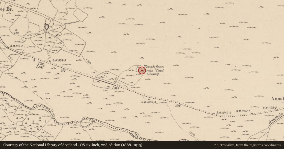
Slide toward Today to fade the historical sheet and see the modern map underneath.
David Rumsey Map Collection, Stanford LibrariesDavid Rumsey Map Collection, Stanford LibrariesDavid Rumsey Map Collection, Stanford LibrariesDavid Rumsey Map Collection, Stanford Libraries
4 historical maps cover this location, the earliest the 1790 map "Composite: Ireland." (David Rumsey Map Collection, Stanford Libraries).
Historical maps covering this location
- 1790 · Composite: Ireland. (David Rumsey Map Collection, Stanford Libraries)
- 1799 · Ireland. (David Rumsey Map Collection, Stanford Libraries)
- 1811 · Ireland. (David Rumsey Map Collection, Stanford Libraries)
- 1891 · Ireland 16 (David Rumsey Map Collection, Stanford Libraries)
This record in the National Monuments Service's Historic Environment Viewer ↗
The National Monuments Service's description
Situated on a gentle to marked S-facing mountain slope in forestry. One of two cairns (see WI016-009005-) identified during a UCD School of Archaeology research and teaching project carried out over three seasons (2004-06). These similarly sized cairns (dims. 2m x 1.7m), consist of mounds of earth and stone and are located in the SE and SW 'corners' of Templefinan Graveyard (WI016-009001-). This cairn in the SE 'corner' is distinctly kerbed around its N side, with quartz stones lying beside it. (O'Sullivan and Warren 2005, 4; O'Sullivan and Warren 2007, 474-5)
Compiled by: Matt Kelleher
Date of upload: 11 January 2013
References
O'Sullivan, A. and Warren, G. 2005 Archaeological Excavations of a Medieval Pilgrims' Church at Templeteenaun, Co. Wicklow. Unpublished Interim Stratigraphical Report.
O'Sullivan, A. and Warren, G. 2007 'Templeteenaun, Ballinagee. In I. Bennett (Ed.) Excavations 2004: summary accounts of archaeological excavations in Ireland, 474-5 (No. 1844). Bray. Wordwell.
Nearby in the register
- Children's burial groundunder 1 mi
- Graveyardunder 1 mi
- Ecclesiastical enclosureunder 1 mi
- Churchunder 1 mi
Other entries of the same register within about three miles of this one, by straight line.