Sites and Monuments Record · Ireland
Bullaun stone (present location)
Kilcoole, County Wicklow, Ireland
The record
- Townland
- Kilcoole
- County
- Wicklow
- Country
- Ireland
- Latest-edition OS map
- Not indicated
- Coordinates
- 53.11084, -6.06584
- SMR number
- WI013-062001-
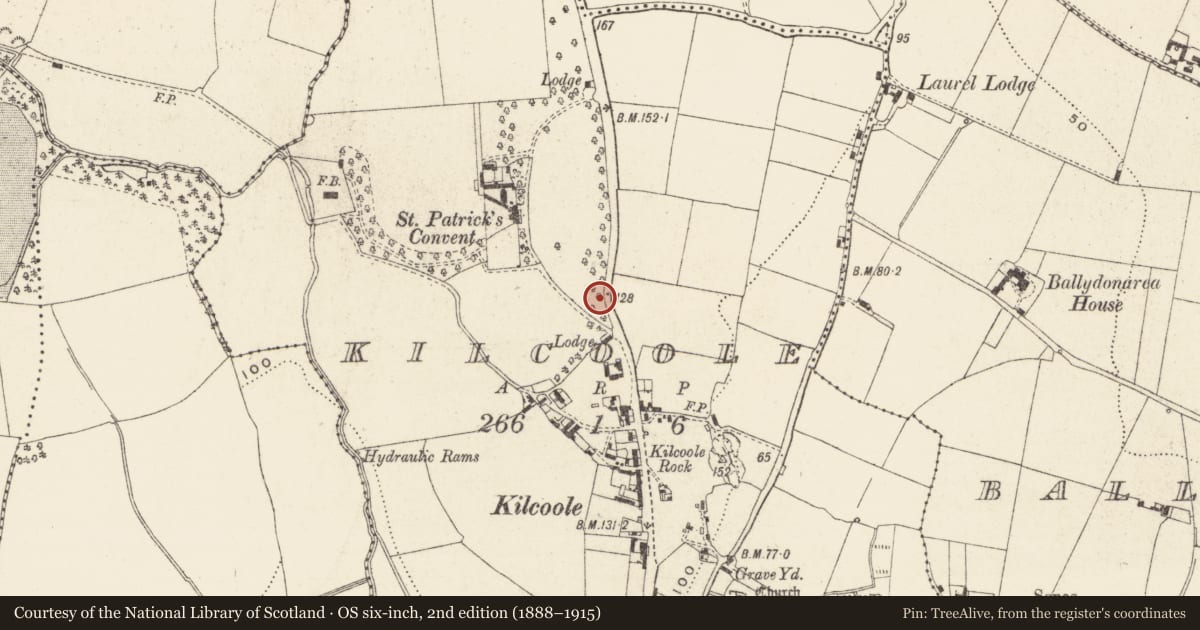
Slide toward Today to fade the historical sheet and see the modern map underneath.
David Rumsey Map Collection, Stanford LibrariesDavid Rumsey Map Collection, Stanford LibrariesDavid Rumsey Map Collection, Stanford LibrariesDavid Rumsey Map Collection, Stanford Libraries
4 historical maps cover this location, the earliest the 1799 map "Ireland." (David Rumsey Map Collection, Stanford Libraries).
Historical maps covering this location
- 1799 · Ireland. (David Rumsey Map Collection, Stanford Libraries)
- 1811 · Ireland. (David Rumsey Map Collection, Stanford Libraries)
- 1841 · Ireland. (David Rumsey Map Collection, Stanford Libraries)
- 1891 · Ireland 16 (David Rumsey Map Collection, Stanford Libraries)
This record in the National Monuments Service's Historic Environment Viewer ↗
The National Monuments Service's description
Recorded by Price in this notebook, dated 4th May 1959, as follows; ‘Patrick Healy told me that a bullaun stone had been found near Kilquade Church and had been brought to the church by Father Masterson, the parish priest. I went to see it today. It is at the E side of the church, placed on the stump of a large tree. It is a very curious stone, a block of granite about 3ft. 3 in. by 2 ft. 3in. [which] has three hollows or basins, much broken, on the one side and a large oval hollow on the opposite side. The large hollow has been placed mouth downwards on the stump, so it is not easy to measure: but it appeared to be (approximately) 23in. by 13in. and 9in. deep, with a hollow worn or ground smooth. On top there are three hollows, all broken on the outer edges: (a) three quarters complete: 12in. x 10in. and 11in. deep: it is the end of the longer axis that is broken away, so the 12in. is an estimate. (2) about half remaining: 8in. deep and it was probably about 10in. in diameter. (3) very much broken away: it was probably about 10in. in diameter: I could not measure the depth. [drawing] This is a rough drawing of the top of this tone with the large oval hollow indicated underneath. The edges of the stone have been broken away, it would seem with a sledgehammer; they are not worn away by weather. The hollows of the three basins are smoothly and evenly rounded.’ (Corlett and Weaver 2002, 644-5).
Compiled by: Paul Walsh
Date of upload: 30 October 2012
References
Corlett, C. and Weaver, M. (eds) 2002 The Price Notebooks. 2 vols. Dúchas the Heritage Service. Dublin.
Nearby in the register
- Furnaceunder 1 mi
- Burialunder 1 mi
- Fontunder 1 mi
- Cross-slabunder 1 mi
Other entries of the same register within about three miles of this one, by straight line.