Sites and Monuments Record · Ireland
Cross
Farrangarret, County Waterford, Ireland
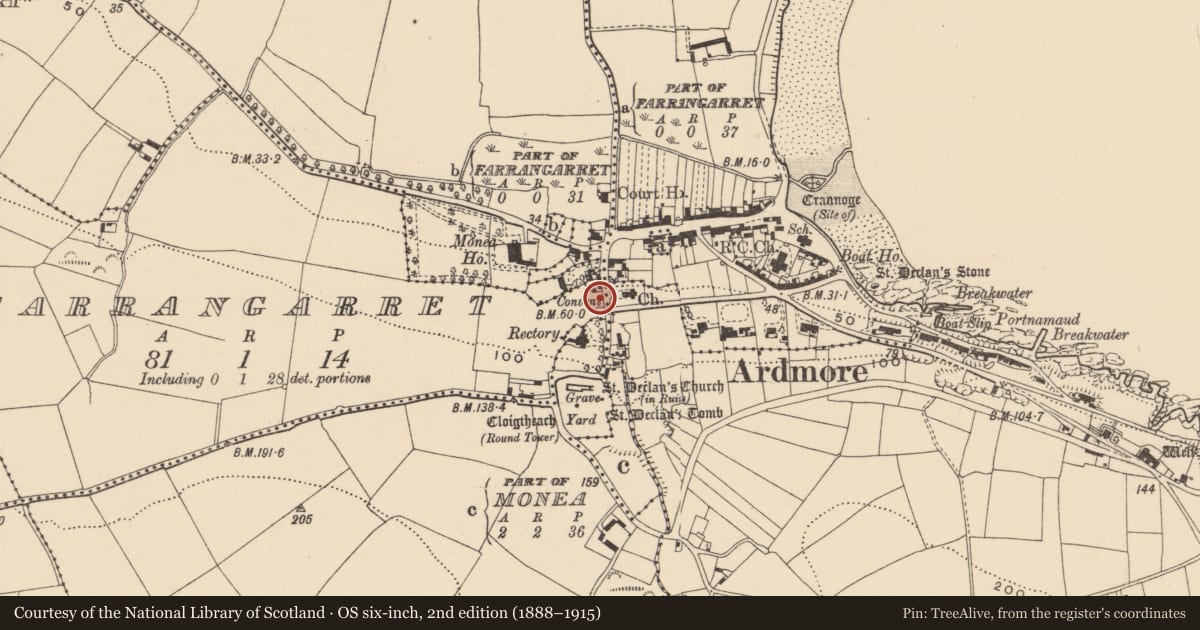
The record
- Townland
- Farrangarret
- County
- Waterford
- Country
- Ireland
- First-edition OS map
- Not indicated
- Latest-edition OS map
- Not indicated
- Coordinates
- 51.95003, -7.72558
- SMR number
- WA040-013----
Slide toward Today to fade the historical sheet and see the modern map underneath.
David Rumsey Map Collection, Stanford LibrariesDavid Rumsey Map Collection, Stanford LibrariesDavid Rumsey Map Collection, Stanford LibrariesDavid Rumsey Map Collection, Stanford Libraries
4 historical maps cover this location, the earliest the 1790 map "Composite: Ireland." (David Rumsey Map Collection, Stanford Libraries).
Historical maps covering this location
- 1790 · Composite: Ireland. (David Rumsey Map Collection, Stanford Libraries)
- 1865 · Ireland, (South) Sheet. (David Rumsey Map Collection, Stanford Libraries)
- 1882 · Ireland (southern half). (David Rumsey Map Collection, Stanford Libraries)
- 1891 · Ireland 16 (David Rumsey Map Collection, Stanford Libraries)
This record in the National Monuments Service's Historic Environment Viewer ↗
The National Monuments Service's description
This cross-base is named as Cloch Daha, attributed to Daghda, King of the Tuatha Dé Dannan, and is described as lying on the roadside opposite the new Church of Ireland church in Ardmore, where it may have been a termon cross at the N edge of the ecclesiastical enclosure (WA040-008023-) around the churches of Ardmore. It is described as "two feet by eighteen inches" and to have a basin. It was the centre of a courtship ritual on Ash Wednesdays (FitzGerald, 1856-7, 43-4). It is now located c. 200m to the NW (WA040-017----), and has a different mythology (Power 1932c, 18; Power 1952, 83) associated with dying cloth. (Westropp 1903, 375)
FitzGerald, E. (1856-7) Proceedings – “Jottings in archaeology”, JRSAI 4, 40-49, 287-91.
Power, Rev. P. (1932c) Ardmore; its founder and early Christian monuments. Catholic Truth Society. Dublin
Power, Rev. P. (1952) The placenames of the Decies. (second ed.) Cork University Press.
Westropp, T. J. (1903) Notes on the antiquities of Ardmore. JRSAI, 33, 353-80.
Compiled by: Michael Moore
Date of upload: 20 October, 2011
Nearby in the register
- Font (present location)under 1 mi
- Ecclesiastical enclosureunder 1 mi
- Churchunder 1 mi
- Ogham stoneunder 1 mi
Other entries of the same register within about three miles of this one, by straight line.