Sites and Monuments Record · Ireland
Promontory fort - coastal
Baile Na Móna Íochtarach, County Waterford, Ireland
The record
- Townland
- Baile Na Móna Íochtarach
- County
- Waterford
- Country
- Ireland
- First-edition OS map
- Not indicated
- Latest-edition OS map
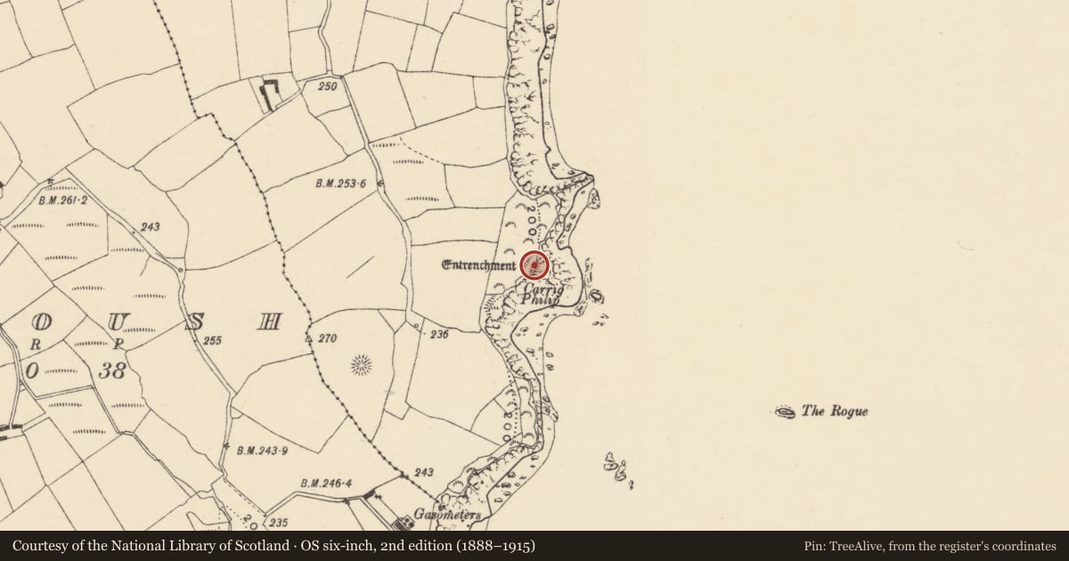
- Entrenchment
- Coordinates
- 51.99702, -7.58333
- SMR number
- WA039-013----
Slide toward Today to fade the historical sheet and see the modern map underneath.
David Rumsey Map Collection, Stanford LibrariesDavid Rumsey Map Collection, Stanford LibrariesDavid Rumsey Map Collection, Stanford LibrariesDavid Rumsey Map Collection, Stanford Libraries
4 historical maps cover this location, the earliest the 1790 map "Composite: Ireland." (David Rumsey Map Collection, Stanford Libraries).
Historical maps covering this location
- 1790 · Composite: Ireland. (David Rumsey Map Collection, Stanford Libraries)
- 1865 · Ireland, (South) Sheet. (David Rumsey Map Collection, Stanford Libraries)
- 1882 · Ireland (southern half). (David Rumsey Map Collection, Stanford Libraries)
- 1891 · Ireland 16 (David Rumsey Map Collection, Stanford Libraries)
This record in the National Monuments Service's Historic Environment Viewer ↗
The National Monuments Service's description
Situated on a coastal promontory jutting E from the mainland. The promonntory is defended at W by a section of rock outcrop (Wth c. 15m; int. H 2.4m; ext. H 2.8m) surmounted by a grass-covered earthen bank (Wth 4m; H 1m) with an outer flat-bottomed fosse (Wth of top 12m; Wth of base 2m; D below rock outcrop 2.8m; ext. D 1.8m). There is a causeway (Wth 6-9m; L 9m) N of the rock outcrop and a rock-cut fosse (L 10m; Wth of top 8m; D 1-2m) N of the causeway (total L of fosse 30m). The interior is rectangular in plan (dims. 22m N-S; 20m E-W). (Westropp 1914-16, 202-3)
Westropp, T. J. (1914-16) Fortiified headlands and castles on the south coast of Munster. PRIA C vol. 32, 188-227.
The above description is derived from the published 'Archaeological Inventory of County Waterford' (Dublin: Stationery Office, 1999). In certain instances the entries have been revised and updated in the light of recent research.
Compiled by: Michael Moore
Date of upload/revision: 17 October 2011
Nearby in the register
- Enclosureunder 1 mi
- Signal towerunder 1 mi
- Megalithic tomb - court tombunder 1 mi
- Ringfort - unclassifiedunder 1 mi
Other entries of the same register within about three miles of this one, by straight line.