Sites and Monuments Record · Ireland
Mill - unclassified
Pilltown, County Waterford, Ireland
The record
- Townland
- Pilltown
- County
- Waterford
- Country
- Ireland
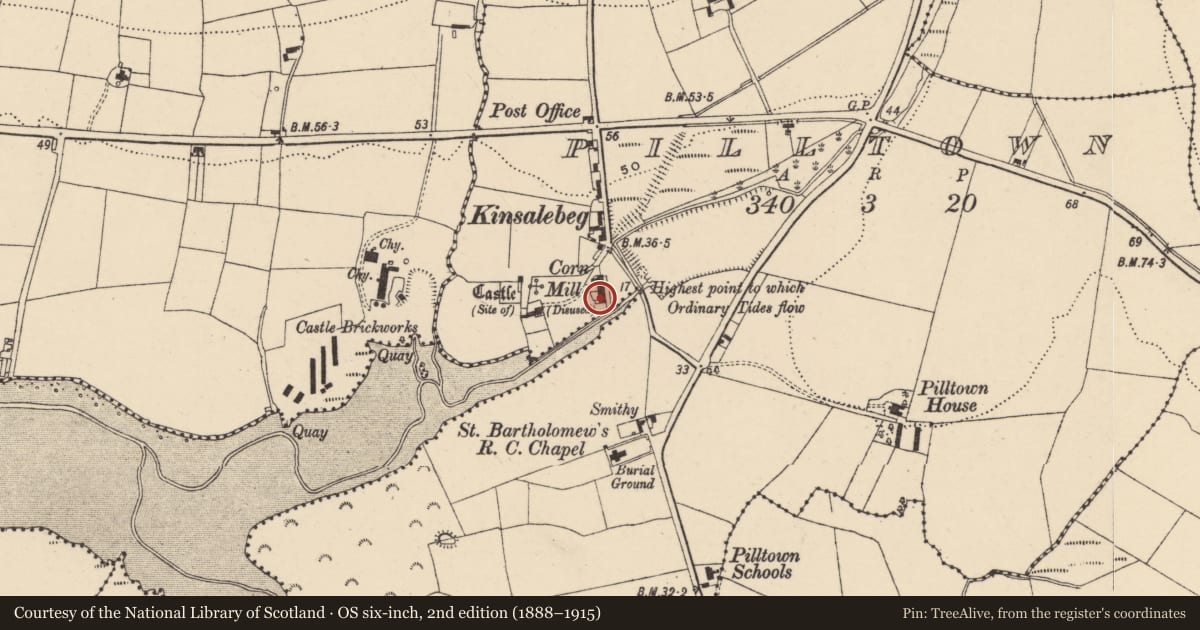
- First-edition OS map
- Flour Mill
- Latest-edition OS map
- Corn Mill (Disused)
- Coordinates
- 51.97257, -7.81092
- SMR number
- WA037-029002-
Slide toward Today to fade the historical sheet and see the modern map underneath.
David Rumsey Map Collection, Stanford LibrariesDavid Rumsey Map Collection, Stanford LibrariesDavid Rumsey Map Collection, Stanford LibrariesDavid Rumsey Map Collection, Stanford Libraries
4 historical maps cover this location, the earliest the 1790 map "Composite: Ireland." (David Rumsey Map Collection, Stanford Libraries).
Historical maps covering this location
- 1790 · Composite: Ireland. (David Rumsey Map Collection, Stanford Libraries)
- 1865 · Ireland, (South) Sheet. (David Rumsey Map Collection, Stanford Libraries)
- 1882 · Ireland (southern half). (David Rumsey Map Collection, Stanford Libraries)
- 1891 · Ireland 16 (David Rumsey Map Collection, Stanford Libraries)
This record in the National Monuments Service's Historic Environment Viewer ↗
The National Monuments Service's description
The location of Kilsalebeg settlement is uncertain but it probably centered on the castle and mill at Pilltown, situated on relatively hisgh overgrown land on the N bank of a NE-SW stream at a point where it emerges onto mud-flats and c. 1.5 km E of the estuary of the Blackwater River. A mill, 'worth £10 in a good year' was the property of Sir Nicholas Walshe of Ballykeeroge (WA023-035001-) in 1640 (Simington 1942, 29). The mill remains date entirely to the 18th or 19th century. Archaeological testing (07E0099) in its vicinity produced one pit (Tierney 2010b). (Bradley et al. 1988, 60-5)
Bradley, J., Halpin, A. and King, H. (1989) Urban archaeology Survey of Waterford City and County, 2 vols. Unpublished report commissioned by the Office of Public Works.
Tierney, J. (2010b) Pilltown mill. Pillotwn. in Bennett (2010) Excavations 2007: summary accounts of archaeological excavations in Ireland, P 519, No. 1836. Wordwell, Dublin.
Simington, R. C. (ed.) (1942) The Civil Survey AD 1654-1656, vi, the County of Waterford. Irish Manuscripts Commission. Dublin.
Compiled by: Michael Moore
Date of upload: 07 October 2011
References
Bradley, J., Halpin, A. and King, H. 1989b Urban archaeological survey - Waterford City and County (2 vols.). Unpublished report commissioned by the Office of Public Works, Dublin.
Simington, R.C. (ed.) 1942 The Civil survey, AD 1654-1656. Vol VI: county of Waterford. Dublin. Irish Manuscripts Commission.
Tierney, J. 2010b Pilltown mill. Pillotwn. in Bennett (2010) Excavations 2007: summary accounts of archaeological excavations in Ireland, P 519, No. 1836. Wordwell, Dublin.
Nearby in the register
- Castle - unclassifiedunder 1 mi
- Settlement clusterunder 1 mi
- Graveyardunder 1 mi
- Churchunder 1 mi
Other entries of the same register within about three miles of this one, by straight line.