Sites and Monuments Record · Ireland
Ecclesiastical enclosure
Island, County Waterford, Ireland
The record
- Townland
- Island
- County
- Waterford
- Country
- Ireland
- First-edition OS map
- Embanked enclosure
- Latest-edition OS map
- Hachured
- Coordinates
- 52.11390, -7.48107
- SMR number
- WA032-029001-
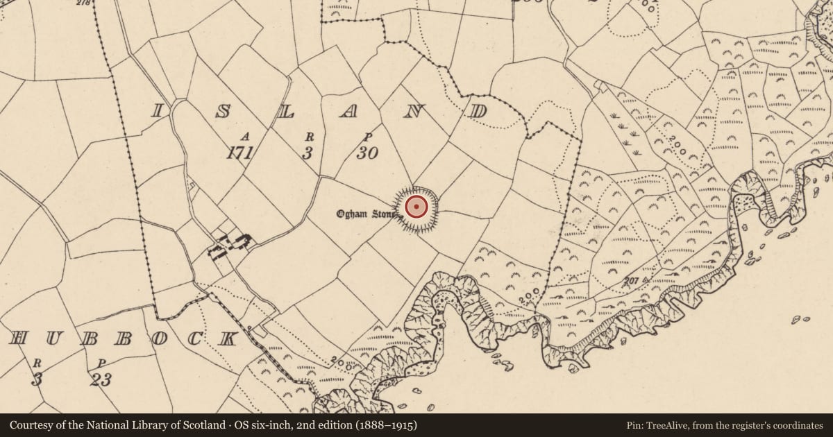
Slide toward Today to fade the historical sheet and see the modern map underneath.
David Rumsey Map Collection, Stanford LibrariesDavid Rumsey Map Collection, Stanford LibrariesDavid Rumsey Map Collection, Stanford LibrariesDavid Rumsey Map Collection, Stanford Libraries
4 historical maps cover this location, the earliest the 1790 map "Composite: Ireland." (David Rumsey Map Collection, Stanford Libraries).
Historical maps covering this location
- 1790 · Composite: Ireland. (David Rumsey Map Collection, Stanford Libraries)
- 1882 · Ireland (southern half). (David Rumsey Map Collection, Stanford Libraries)
- 1891 · Ireland 16 (David Rumsey Map Collection, Stanford Libraries)
- 1904 · Sheet 13. (David Rumsey Map Collection, Stanford Libraries)
This record in the National Monuments Service's Historic Environment Viewer ↗
The National Monuments Service's description
Situated just below the summit of a gentle NE-facing slope, with sea cliffs c. 130m to the S. This is possibly an early ecclesiastical site. The enclosure is a large, grass-covered circular area (diam. 85.5m E-W; 83.5m N-S) defined by an overgrown earthen field bank with internal and external stone-facing (Wth c. 2-3m; H c. 1-2m). The entrance (Wth 2.1m) at W is possibly modern. There is an ogham stone (WA032-029002-) and a small cross-inscribed stone in the interior, but the bullaun stone (WA032-029003-) recorded by Westropp (1906, 250-51; 1914-16, 226) is a saddle quern.
Compiled by: Michael Moore.
Date of upload: 27th September, 2011.
References
Westropp, T.J. 1906 Notes on certain promontory forts in the counties of Waterford and Wexford. Journal of the Royal Society of Antiquaries of Ireland 36, 239-58.
Westropp, T.J. 1914-16 Fortified headlands and castles on the south coast of Munster: Part II, from Ardmore to Dunmore, Co. Waterford. Proceedings of the Royal Irish Academy 32C, 188-227.
Nearby in the register
- Ogham stoneunder 1 mi
- Cross-inscribed stoneunder 1 mi
- Ringfort - rathunder 1 mi
- Souterrainunder 1 mi
Other entries of the same register within about three miles of this one, by straight line.