Sites and Monuments Record · Ireland
Cave
Ballynacourty (Decies without Drum By., Whitechurch Par.), County Waterford, Ireland
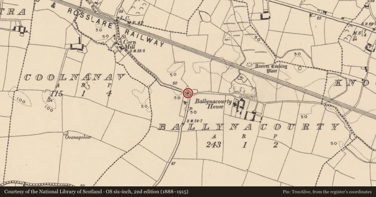
The record
- Townland
- Ballynacourty (Decies without Drum By., Whitechurch Par.)
- County
- Waterford
- Country
- Ireland
- First-edition OS map
- Not indicated
- Latest-edition OS map
- Not indicated
- Coordinates
- 52.11007, -7.71556
- SMR number
- WA030-085----
Slide toward Today to fade the historical sheet and see the modern map underneath.
David Rumsey Map Collection, Stanford LibrariesDavid Rumsey Map Collection, Stanford LibrariesDavid Rumsey Map Collection, Stanford LibrariesDavid Rumsey Map Collection, Stanford Libraries
4 historical maps cover this location, the earliest the 1790 map "Composite: Ireland." (David Rumsey Map Collection, Stanford Libraries).
Historical maps covering this location
- 1790 · Composite: Ireland. (David Rumsey Map Collection, Stanford Libraries)
- 1882 · Ireland (southern half). (David Rumsey Map Collection, Stanford Libraries)
- 1891 · Ireland 16 (David Rumsey Map Collection, Stanford Libraries)
- 1904 · Sheet 13. (David Rumsey Map Collection, Stanford Libraries)
This record in the National Monuments Service's Historic Environment Viewer ↗
The National Monuments Service's description
Situated in a quarry known locally as Quinlan's quarry in the Cappagh valley, and close to the point where the NW-SE Douglas River runs underground. Human remains from this quarry are now in NMI. (SMR file)
Compiled by: Michael Moore.
Date of upload: 11 August, 2011
Nearby in the register
- House - 18th/19th centuryunder 1 mi
- Burnt moundunder 1 mi
- Caveunder 1 mi
- Water mill - horizontal-wheeledunder 1 mi
Other entries of the same register within about three miles of this one, by straight line.