Sites and Monuments Record · Ireland
Cross-inscribed stone (present location)
Cappagh (Decies without Drum By.), County Waterford, Ireland
The record
- Townland
- Cappagh (Decies without Drum By.)
- County
- Waterford
- Country
- Ireland
- First-edition OS map
- Not indicated
- Latest-edition OS map
- Altar Stone
- Coordinates
- 52.12137, -7.73588
- SMR number
- WA030-006003-
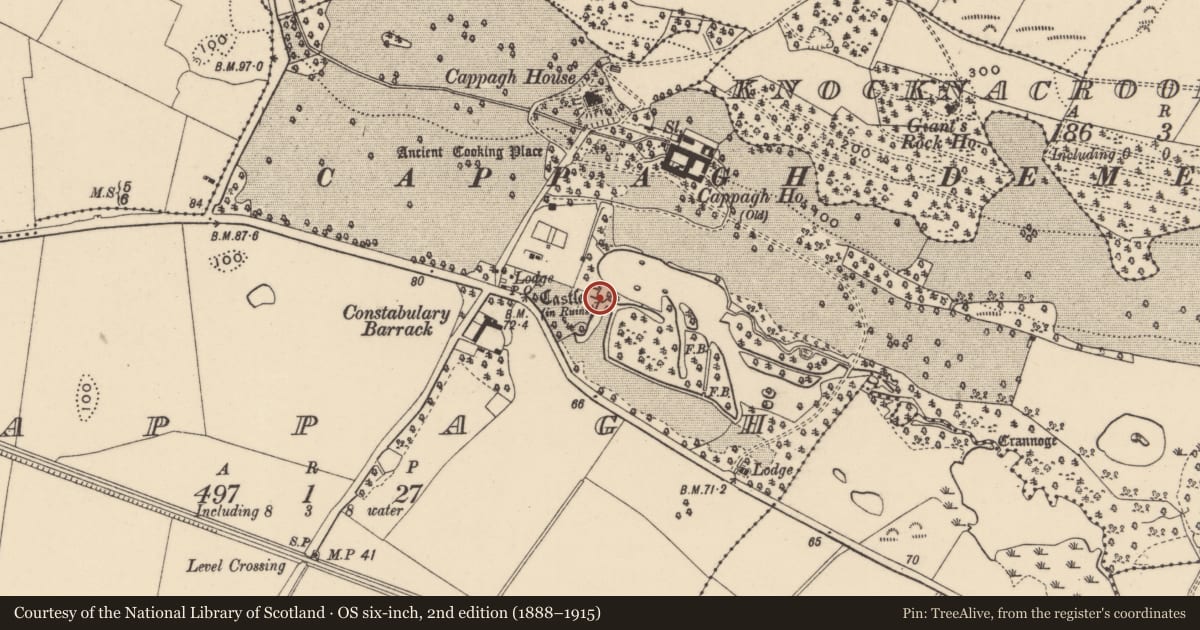
Slide toward Today to fade the historical sheet and see the modern map underneath.
David Rumsey Map Collection, Stanford LibrariesDavid Rumsey Map Collection, Stanford LibrariesDavid Rumsey Map Collection, Stanford LibrariesDavid Rumsey Map Collection, Stanford Libraries
4 historical maps cover this location, the earliest the 1790 map "Composite: Ireland." (David Rumsey Map Collection, Stanford Libraries).
Historical maps covering this location
- 1790 · Composite: Ireland. (David Rumsey Map Collection, Stanford Libraries)
- 1882 · Ireland (southern half). (David Rumsey Map Collection, Stanford Libraries)
- 1891 · Ireland 16 (David Rumsey Map Collection, Stanford Libraries)
- 1904 · Sheet 13. (David Rumsey Map Collection, Stanford Libraries)
This record in the National Monuments Service's Historic Environment Viewer ↗
The National Monuments Service's description
Located in mixed woodland on the floor of the Cappagh valley. The cross-inscribed stone, possibly an altar stone, from Knockmaon church (WA030-042001-) is now outside the E wall of the bawn (WA030-006002-) attached to Cappagh tower house (WA030-006001-) (Power 1918a, 90). It is a granite block (min. dims. 2.25m x 0.7m; T 0.25m) with a ringed-cross in relief at the centre of one side. (Redmond 1895, 262; O'Connell-Redmond 1918-19, 102)
O'Connell-Redmond, G. (1918) The castles of north-east Cork and near its borders. JCHAS 24, 1-6, 62-6, 93-103, 145-51.
Power, Rev. P. (1898a) Ancient ruined churches of Co. Waterford, WAJ 4, 83-95, 195-219.
Redmond, G. (1885-6a) Notes on the history, antiquities, archaeoloical remains and legends connected with the western end of the county Waterford, JRSAI, 17, 394-405.
Date of upload/revision: 11th August, 2011. Compiled by: Michael Moore.
Nearby in the register
- Bawnunder 1 mi
- Castle - tower houseunder 1 mi
- Fulacht fiaunder 1 mi
- Barrow - mound barrowunder 1 mi
Other entries of the same register within about three miles of this one, by straight line.