Sites and Monuments Record · Ireland
Bullaun stone
Curraghroche, County Waterford, Ireland
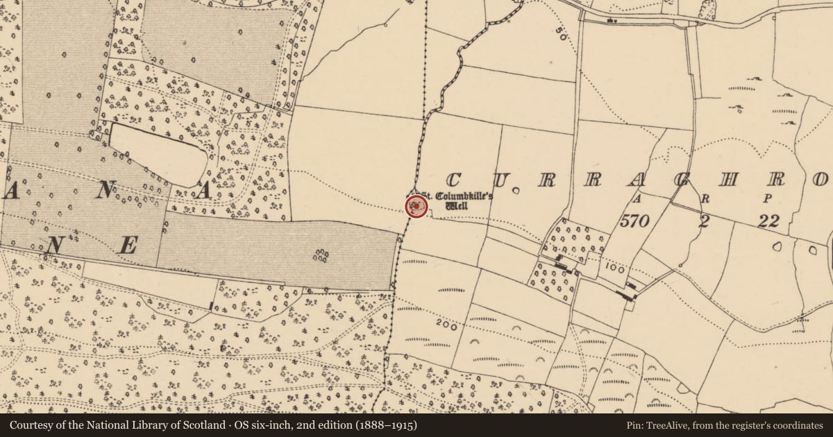
The record
- Townland
- Curraghroche
- County
- Waterford
- Country
- Ireland
- First-edition OS map
- Not indicated
- Latest-edition OS map
- Not indicated
- Coordinates
- 52.10512, -7.83848
- SMR number
- WA029-023003-
Slide toward Today to fade the historical sheet and see the modern map underneath.
David Rumsey Map Collection, Stanford LibrariesDavid Rumsey Map Collection, Stanford LibrariesDavid Rumsey Map Collection, Stanford LibrariesDavid Rumsey Map Collection, Stanford Libraries
4 historical maps cover this location, the earliest the 1790 map "Composite: Ireland." (David Rumsey Map Collection, Stanford Libraries).
Historical maps covering this location
- 1790 · Composite: Ireland. (David Rumsey Map Collection, Stanford Libraries)
- 1882 · Ireland (southern half). (David Rumsey Map Collection, Stanford Libraries)
- 1891 · Ireland 16 (David Rumsey Map Collection, Stanford Libraries)
- 1904 · Sheet 13. (David Rumsey Map Collection, Stanford Libraries)
This record in the National Monuments Service's Historic Environment Viewer ↗
The National Monuments Service's description
Located in a wooded depression on a gentle N-facing slope. The holy well (wa029-023001-) was venerated in the 19th century (O'C. Redmond 1895, 155-6) and there is a record of a possible bullaun stone, and of a carved stone head (wa029-023002-) built into the surrounding canopy (Buckley 1896, 214). A circular well with a canopy survives but the other features are not visible. (O'Keeffe 1994, 132)
Buckley, M. J. C. (1896) Notes on Kilmolash Church, Near Cappoquin, Co. Waterford, WAJ vol. 2, 212-20.
O'C. Redmond, G. (1895) Notes on the history, antiquities, archaeological remains and legends connected with the western end of the county Waterford, part II.WAJ 1, 119-32, 147-61.
O'Keefe, T. (1994) Lismore and Cashel: reflections on the beginnings of Romanesque architecture in Munster. JRSAI 124, 118-52.
Compiled by: Michael Moore
Date of upload: 26 July 2011
References
Redmond, G. O'Connell 1895 Notes on the history, antiquities, archaeological remains and legends connected with the western end of the County Waterford. Waterford and South East of Ireland Archaeological Journal 1, 119-32, 147-61.
Buckley, M.J.C. 1896 Notes on Kilmolash Church, near Cappoquin, Co. Waterford. Waterford and South East of Ireland Archaeological Journal 2, 212-20.
O'Keeffe, T. 1994 Lismore and Cashel: reflections on the beginnings of Romanesque architecture in Munster. JRSAI 124, 118-52.
Nearby in the register
- Ritual site - holy wellunder 1 mi
- Architectural fragmentunder 1 mi
- Ringfort - unclassifiedunder 1 mi
- Churchunder 1 mi
Other entries of the same register within about three miles of this one, by straight line.