Sites and Monuments Record · Ireland
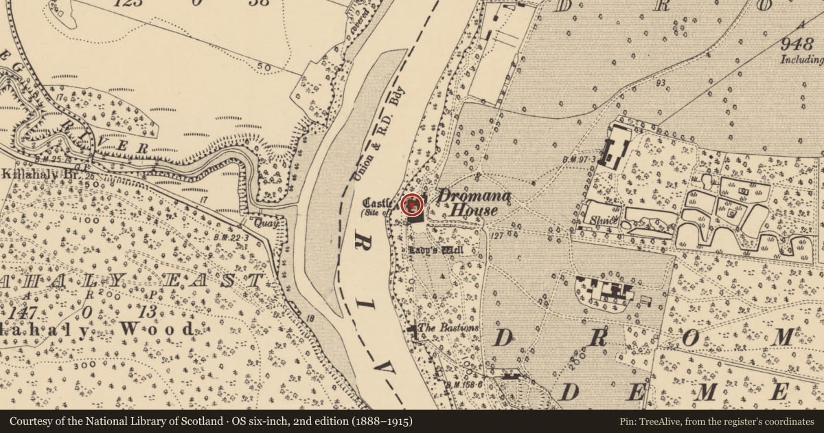
House - 17th century
Dromana (Decies without Drum By.), County Waterford, Ireland
The record
- Townland
- Dromana (Decies without Drum By.)
- County
- Waterford
- Country
- Ireland
- First-edition OS map
- Dromana Ho.
- Latest-edition OS map
- Dromana House
- Coordinates
- 52.10797, -7.86548
- SMR number
- WA029-021002-
Slide toward Today to fade the historical sheet and see the modern map underneath.
David Rumsey Map Collection, Stanford LibrariesDavid Rumsey Map Collection, Stanford LibrariesDavid Rumsey Map Collection, Stanford LibrariesDavid Rumsey Map Collection, Stanford Libraries
4 historical maps cover this location, the earliest the 1790 map "Composite: Ireland." (David Rumsey Map Collection, Stanford Libraries).
Historical maps covering this location
- 1790 · Composite: Ireland. (David Rumsey Map Collection, Stanford Libraries)
- 1882 · Ireland (southern half). (David Rumsey Map Collection, Stanford Libraries)
- 1891 · Ireland 16 (David Rumsey Map Collection, Stanford Libraries)
- 1904 · Sheet 13. (David Rumsey Map Collection, Stanford Libraries)
This record in the National Monuments Service's Historic Environment Viewer ↗
The National Monuments Service's description
Situated on a bluff overlooking the N-S Blackwater River, which is immediately to the W. A Fitzgerald castle was the caput of the manor of the Lords of Decies, descended from Gerald Mór, son of James, the seventh Earl of Desmond. It was probably built by Gerald Mór in the late 15th century. It escaped the Desmond forfeitures and the Cromwellian confiscations of the 17th century (Power 1908b, 6-7) to become through marriage the seat of the Villier-Stuart family in the 18th and 19th centuries.
The medieval buildings (WA029-021001-) were demolished in the 17th century, apart from the base of a large circular tower perched over the river and a coeval wall (L c. 8m; H c. 6m) extending N to the base of a tower house. A window from the tower house is built into a late 17th-century house of eight bays and two storeys extending N on an L-shaped plan which was illustrated by Daniel Grose c. 1820 (Stalley 1991, 58-60). The roof is steeply pitched and the fenestration is original. An armorial crest in relief with the inscribed date 1745 is built into a gable. Later 18th- and 19th-century ranges are now demolished, and the house is still occupied. (Ryland 1824, 315-17)
Power, Rev. P. (1908b) Dromore to Lismore - with notes on the antiquiteis to be visited on the society's annual excurstion, WAJ 12, 1-16.
Ryland, Rev. R. H. (1824) The History, topography and antiquities of the county and city of Waterford. John Murray. London.
Stalley, R. (1991) Daniel Grosse (c. 1776-1838): the antiquities pf Ireland. The Irish Architectural Archive. Dublin.
Compiled by: Michael Moore
Date of upload: 26 July 2011
References
Stalley, R. (ed.) 1991 Daniel Grose (c. 1766–1838). The antiquities of Ireland, a supplement to Francis Grose. Dublin. The Irish Architectural Archive.
Power, Rev. P. 1908b Dromore to Lismore - with notes on the antiquities to be visited on the society's annual excursion. Waterford and South East of Ireland Archaeological Journal 2, 1-16.
Ryland, Rev. R.H. 1824 The history, topography and antiquities of the city and county of Waterford. London. John Murray.
Nearby in the register
- Castle - tower houseunder 1 mi
- Bawnunder 1 mi
- Wellunder 1 mi
- Linear earthworkunder 1 mi
Other entries of the same register within about three miles of this one, by straight line.