Sites and Monuments Record · Ireland
Promontory fort - coastal
Portally, County Waterford, Ireland
The record
- Townland
- Portally
- County
- Waterford
- Country
- Ireland
- First-edition OS map
- Not indicated
- Latest-edition OS map
- Not indicated
- Coordinates
- 52.13468, -7.02566
- SMR number
- WA027-089----
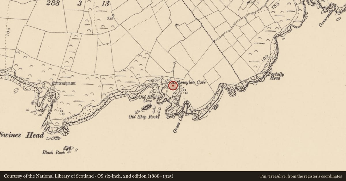
Slide toward Today to fade the historical sheet and see the modern map underneath.
David Rumsey Map Collection, Stanford LibrariesDavid Rumsey Map Collection, Stanford LibrariesDavid Rumsey Map Collection, Stanford LibrariesDavid Rumsey Map Collection, Stanford Libraries
4 historical maps cover this location, the earliest the 1790 map "Composite: Ireland." (David Rumsey Map Collection, Stanford Libraries).
Historical maps covering this location
- 1790 · Composite: Ireland. (David Rumsey Map Collection, Stanford Libraries)
- 1869 · Ireland. (David Rumsey Map Collection, Stanford Libraries)
- 1882 · Ireland (southern half). (David Rumsey Map Collection, Stanford Libraries)
- 1891 · Ireland 16 (David Rumsey Map Collection, Stanford Libraries)
This record in the National Monuments Service's Historic Environment Viewer ↗
The National Monuments Service's description
Identified from an aerial survey by Markus Casey who described this monument as a large rectangular headland (L 90m; max. Wth 33m), flanked by a gully to the SE and by a blow-hole and cliff on the W which was cut off from the mainland by exploiting a natural cleft running along the E side. A fosse dug along the landward side leaving a causeway close to the blow-hole along the W completed the enclosure. A gentle rise on either side of the fosse and along the eastern gully suggests a former bank. A land commission earthen bank surrounds the headland, except along the E where it has recently collapsed into the sea. On the extremity of the headland is a small subsidiary promontory, which was in turn cut off by a low earthen bank and slight ditch across its narrow neck (Wth 7m). The area is one of undulating fertile overgrazed pasture with 100' cliffs. (Casey 2001)
Compiled by: Jean Farrelly
Date of upload: 24 November 2021
References
Casey, M. 2001 The coastal promontory forts of Ireland: interim report for the Heritage Council. Unpublished specialist report, National Monuments Service, Department of Arts, Heritage and the Gaeltacht.
Nearby in the register
- Promontory fort - coastalunder 1 mi
- Moundunder 1 mi
- Ringfort - rathunder 1 mi
- Metalworking siteunder 1 mi
Other entries of the same register within about three miles of this one, by straight line.