Sites and Monuments Record · Ireland
Boundary stone
Durrow, County Waterford, Ireland
The record
- Townland
- Durrow
- County
- Waterford
- Country
- Ireland
- First-edition OS map
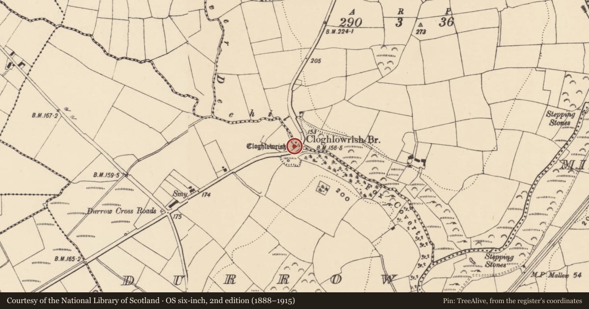
- Cloghlourish
- Latest-edition OS map
- Cloghlowrish
- Coordinates
- 52.14598, -7.51115
- SMR number
- WA024-045----
Slide toward Today to fade the historical sheet and see the modern map underneath.
David Rumsey Map Collection, Stanford LibrariesDavid Rumsey Map Collection, Stanford LibrariesDavid Rumsey Map Collection, Stanford LibrariesDavid Rumsey Map Collection, Stanford Libraries
4 historical maps cover this location, the earliest the 1790 map "Composite: Ireland." (David Rumsey Map Collection, Stanford Libraries).
Historical maps covering this location
- 1790 · Composite: Ireland. (David Rumsey Map Collection, Stanford Libraries)
- 1882 · Ireland (southern half). (David Rumsey Map Collection, Stanford Libraries)
- 1891 · Ireland 16 (David Rumsey Map Collection, Stanford Libraries)
- 1904 · Sheet 13. (David Rumsey Map Collection, Stanford Libraries)
This record in the National Monuments Service's Historic Environment Viewer ↗
The National Monuments Service's description
Situated on the SE bank of the NW-SE Deehil River, c. 550m NW of the point where it joins the River Tay. This is a large glacial erratic that has split into two portions, and it is known as Clogh Leabhrais - the speaking stone. Traditionally, it confirmed truths pronounced before it, but it was confounded by an adulterous woman on one occasion and spit in frustration. The story was well known in the 17th century (Walton 1987, 29). (Ryland 1824, 304; O'Flanagan 1929, 29-30; J.C. 1908)
Compiled by: Michael Moore.
Date of upload: 26th September, 2011.
References
O'Flanagan, Rev. M. (Compiler) 1929 Letters containing information relative to the antiquities of the county of Waterford collected during the progress of the Ordnance Survey in 1841. Bray.
J.C. 1908 Notes and queries – A county Waterford speaking-stone. Waterford and South East of Ireland Archaeological Journal 11, 42.
Walton, J. 1987 Two descriptions of County Waterford in the 1680s. Decies, no. 36, 25-33.
Ryland, Rev. R.H. 1824 The history, topography and antiquities of the city and county of Waterford. London. John Murray.
Nearby in the register
- Bullaun stoneunder 1 mi
- Ringfort - rathunder 1 mi
- Bullaun stoneunder 1 mi
- Souterrainunder 1 mi
Other entries of the same register within about three miles of this one, by straight line.