Sites and Monuments Record · Ireland
Barracks
Newtown (Gaultiere By., Crooke Par.), County Waterford, Ireland
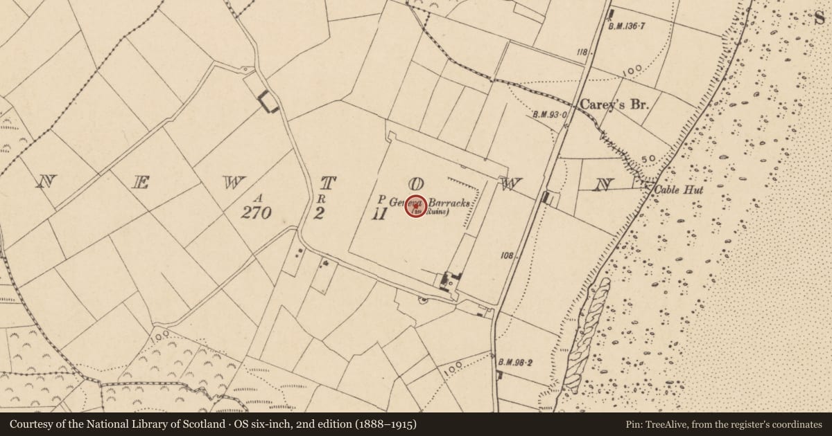
The record
- Townland
- Newtown (Gaultiere By., Crooke Par.)
- County
- Waterford
- Country
- Ireland
- First-edition OS map
- Geneve Barracks (in ruins)
- Latest-edition OS map
- Geneva Barracks (in Ruins)
- Coordinates
- 52.21904, -6.98032
- SMR number
- WA018-024----
Slide toward Today to fade the historical sheet and see the modern map underneath.
David Rumsey Map Collection, Stanford LibrariesUniversity Library, Vrije Universiteit AmsterdamDavid Rumsey Map Collection, Stanford LibrariesDavid Rumsey Map Collection, Stanford Libraries
4 historical maps cover this location, the earliest the 1790 map "Composite: Ireland." (David Rumsey Map Collection, Stanford Libraries).
Historical maps covering this location
- 1790 · Composite: Ireland. (David Rumsey Map Collection, Stanford Libraries)
- 1869 · Ireland. (David Rumsey Map Collection, Stanford Libraries)
- 1891 · Ireland 16 (David Rumsey Map Collection, Stanford Libraries)
- 1911 · Sheet 14, 1911 (University Library, Vrije Universiteit Amsterdam)
This record in the National Monuments Service's Historic Environment Viewer ↗
The National Monuments Service's description
Situated on top of cliffs on the W side of the Barrow/Suir estuary. An ideal town was planned to accommodate Genevan democrats displaced during the Swiss revolution in 1782. Grants of land at Newtown, Co. Waterford and Passage amounting to 11,000 acres, as well as money were made by Lord Temple, the Viceroy, to build 50 houses as well as public buildings and an Academy. However the immigrants never arrived and the town failed to materialise (Butler 1947). A military barracks was erected on the site in the 1780s which functioned as a prison during the 1798 Rebellion, but it was abandoned by 1841. This is a subrectangular area (dims. c. 250m N-S; c. 240m E-W) defined by mortared stone walls (H 3-4m) with corner bastions, all of which survive except that at the SE. The remains of a terrace of buildings survive parallel to the N wall, which also has an entrance gate. (Butler 1912; 1913; 1914; Decie 1983, 46; Dowling 1985)
Butler, H. (1947) New Geneva in Waterford, JRSAI 77, 150-5.
Butler, M. (1912) New Geneva; some correspondence relating to its foundation, WAJ, 15, 181-94.
Butler, M. (1913) New Geneva; some correspondence relating to its foundation (continued), WAJ, 16, 1-17, 86-92.
Butler, M. (1914) New Geneva; some correspondence relating to its foundation, WAJ, 17, 164-9.
Decie (1983) Old Waterford Society Survey, Decies No. 24, 42-57.
Dowling, D. (1985) New Geneva, Decies, No. 29, 32-40
The above description is derived from the published 'Archaeological Inventory of County Waterford' (Dublin: Stationery Office, 1999). In certain instances the entries have been revised and updated in the light of recent research.
Date of upload/revision: 23 December 2008
Nearby in the register
- Field systemunder 1 mi
- Burnt moundunder 1 mi
- Castle - tower houseunder 1 mi
- Ritual site - holy wellunder 1 mi
Other entries of the same register within about three miles of this one, by straight line.