Sites and Monuments Record · Ireland
Megalithic tomb - wedge tomb
Munmahoge (Middlethird By., Kilburne Par.), County Waterford, Ireland
The record
- Townland
- Munmahoge (Middlethird By., Kilburne Par.)
- County
- Waterford
- Country
- Ireland
- First-edition OS map
- Not indicated
- Latest-edition OS map
- Dolmen
- Coordinates
- 52.20398, -7.15719
- SMR number
- WA017-035----
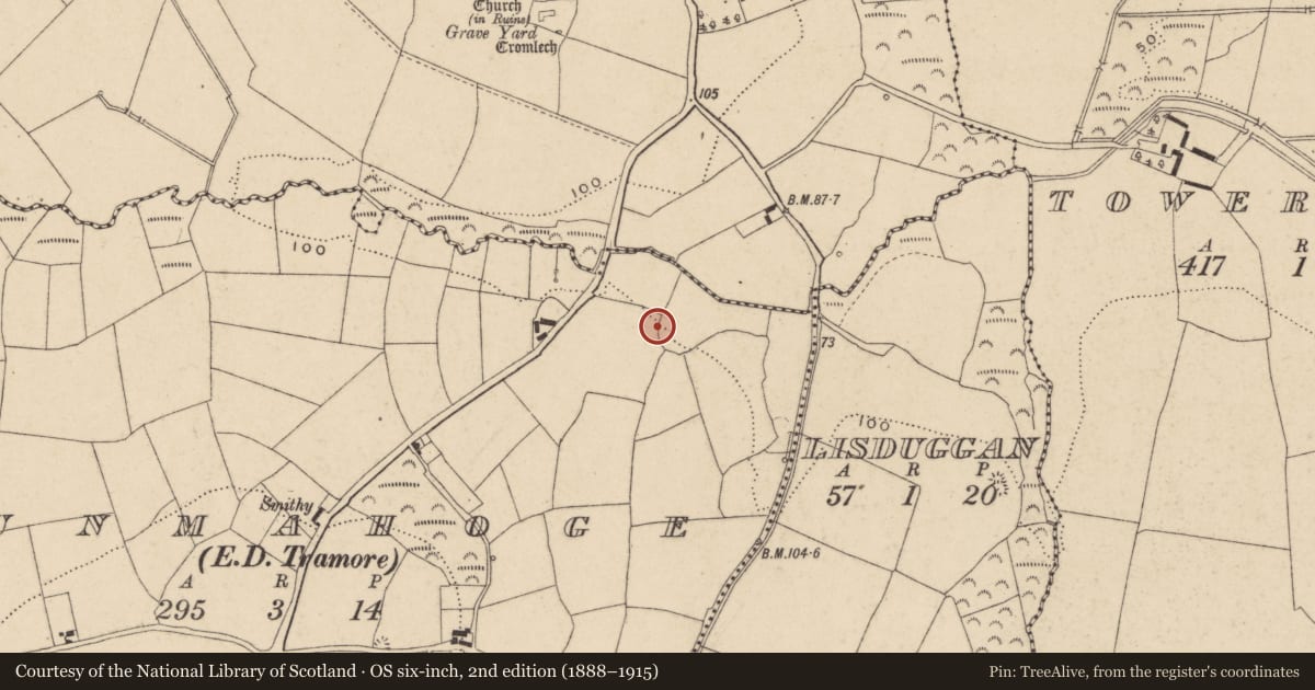
Slide toward Today to fade the historical sheet and see the modern map underneath.
David Rumsey Map Collection, Stanford LibrariesUniversity Library, Vrije Universiteit AmsterdamDavid Rumsey Map Collection, Stanford LibrariesDavid Rumsey Map Collection, Stanford Libraries
4 historical maps cover this location, the earliest the 1790 map "Composite: Ireland." (David Rumsey Map Collection, Stanford Libraries).
Historical maps covering this location
- 1790 · Composite: Ireland. (David Rumsey Map Collection, Stanford Libraries)
- 1882 · Ireland (southern half). (David Rumsey Map Collection, Stanford Libraries)
- 1891 · Ireland 16 (David Rumsey Map Collection, Stanford Libraries)
- 1911 · Sheet 14, 1911 (University Library, Vrije Universiteit Amsterdam)
This record in the National Monuments Service's Historic Environment Viewer ↗
The National Monuments Service's description
Situated in scrub at the crest of a N-facing slope. This is an undifferentiated passage (L 3m; Wth 0.9m) oriented E-W with three sidestones on each side and one surviving lintel. A blocking-stone, two stones of a façade and outer-walling on the S side of the passage also survive. (Ó Nualláin and Walsh 1986, 26, 28) There is a large orthostat (dims. 2.45m x 0.7m; H 1.6m) NW of the wedge tomb. A field boundary runs immediately W of the tomb and dumped along the W side of this boundary for 22m N of the tomb and 9m to S there are small to medium sized stones from field clearance. These terminate 10m S of the tomb in a group of four large flat-sided boulders, one of which (dims. 2.1m x 0.7m; H 1.05m) is upright against the field boundary, one is lying against the field boundary (2.6m x 1.3m x T 0.6m), one is partially resting on the former (2m x 1.5m x T 0.6m) and the third (2m x 1.3m x T 0.5m) is partially resting on this one.
The above description is derived from the published 'Archaeological Inventory of County Waterford' (Dublin: Stationery Office, 1999). In certain instances the entries have been revised and updated in the light of recent research.
Date of revised upload: 12 October 2016
References
Ó Nualláin, S. and Walsh, P. 1986 A reconsideration of the Tramore passage tombs. Proceedings of the Prehistoric Society 52, 25-9.
Nearby in the register
- Megalithic tomb - portal tombunder 1 mi
- Graveyardunder 1 mi
- Churchunder 1 mi
- Ringfort - unclassifiedunder 1 mi
Other entries of the same register within about three miles of this one, by straight line.