Sites and Monuments Record · Ireland
Megalithic tomb - portal tomb
Ballindud, County Waterford, Ireland
The record
- Townland
- Ballindud
- County
- Waterford
- Country
- Ireland
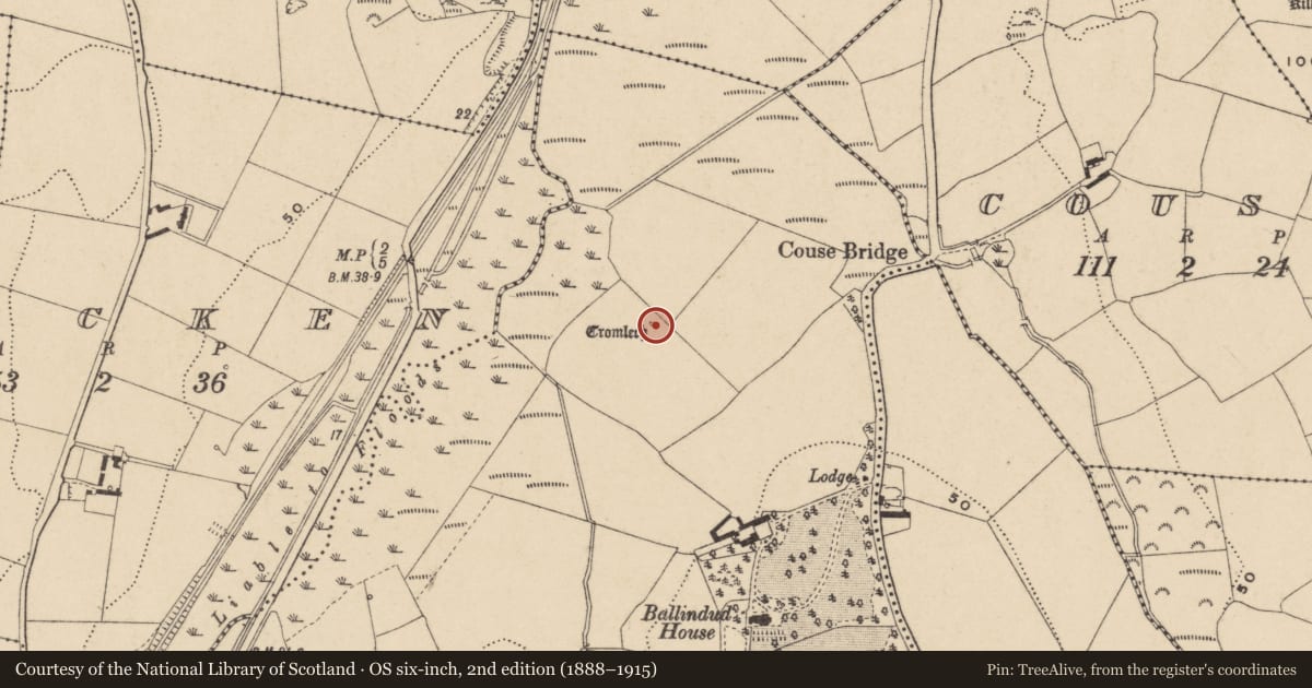
- First-edition OS map
- Cromlech
- Latest-edition OS map
- Dolmen
- Coordinates
- 52.22765, -7.11946
- SMR number
- WA017-016----
Slide toward Today to fade the historical sheet and see the modern map underneath.
David Rumsey Map Collection, Stanford LibrariesUniversity Library, Vrije Universiteit AmsterdamDavid Rumsey Map Collection, Stanford LibrariesDavid Rumsey Map Collection, Stanford Libraries
4 historical maps cover this location, the earliest the 1790 map "Composite: Ireland." (David Rumsey Map Collection, Stanford Libraries).
Historical maps covering this location
- 1790 · Composite: Ireland. (David Rumsey Map Collection, Stanford Libraries)
- 1882 · Ireland (southern half). (David Rumsey Map Collection, Stanford Libraries)
- 1891 · Ireland 16 (David Rumsey Map Collection, Stanford Libraries)
- 1911 · Sheet 14, 1911 (University Library, Vrije Universiteit Amsterdam)
This record in the National Monuments Service's Historic Environment Viewer ↗
The National Monuments Service's description
Situated in rough pasture, on a gentle W-facing slope. A subcircular roofstone (dims. 4.3m x 3.8m; max. T 1m) is supported on one stone and facing SW. It is depicted in Ryland (1824, 299-300) as supported on a second portal-stone with a tall backstone. (Atkins 1896, 71; Borlase 1897, vol. 1, 62-3; Ó Nualláin 1983, 103)
Atkins, R. (1896) The rude stone monuments of our own and other lands. WAJ. Vol. 2, 131-61.
Borlase, W. C. (1897) The dolmens of Ireland. 3 vols. Chapman and Hall, London.
Ó Nualláin, S. (1983) Irish portal tombs: topography, siting and distribution. JRSAI 113, 102-03.
Ryland, Rev. R. H. (1824) The History, topography and antiquities of the county and city of Waterford. John Murray. London.
The above description is derived from the published 'Archaeological Inventory of County Waterford' (Dublin: Stationery Office, 1999). In certain instances the entries have been revised and updated in the light of recent research.
Date of upload: 23 December 2008
Revised by: Michael Moore
Revised on: 20 March 2013
Nearby in the register
- Standing stoneunder 1 mi
- Bridgeunder 1 mi
- Ringfort - unclassifiedunder 1 mi
- Burnt moundunder 1 mi
Other entries of the same register within about three miles of this one, by straight line.