Sites and Monuments Record · Ireland
Ecclesiastical enclosure
Kill St. Lawrence, County Waterford, Ireland
The record
- Townland
- Kill St. Lawrence
- County
- Waterford
- Country
- Ireland
- First-edition OS map
- Not indicated
- Latest-edition OS map
- Not indicated
- Coordinates
- 52.23127, -7.10381
- SMR number
- WA017-005004-
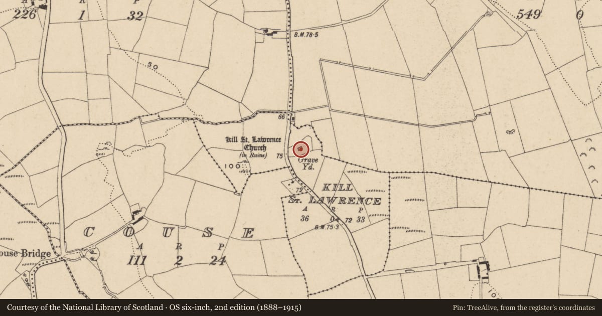
Slide toward Today to fade the historical sheet and see the modern map underneath.
David Rumsey Map Collection, Stanford LibrariesUniversity Library, Vrije Universiteit AmsterdamDavid Rumsey Map Collection, Stanford LibrariesDavid Rumsey Map Collection, Stanford Libraries
4 historical maps cover this location, the earliest the 1790 map "Composite: Ireland." (David Rumsey Map Collection, Stanford Libraries).
Historical maps covering this location
- 1790 · Composite: Ireland. (David Rumsey Map Collection, Stanford Libraries)
- 1882 · Ireland (southern half). (David Rumsey Map Collection, Stanford Libraries)
- 1891 · Ireland 16 (David Rumsey Map Collection, Stanford Libraries)
- 1911 · Sheet 14, 1911 (University Library, Vrije Universiteit Amsterdam)
This record in the National Monuments Service's Historic Environment Viewer ↗
The National Monuments Service's description
Situated on a slight rise in a low-lying landscape. An early ecclesiastical site and the parish church of Kill St Lawrence (WA017-005001-) is within a rectangular, neglected graveyard (WA017-005002-). The graveyard is within a larger circular ecclesiastical enclosure in rough pasture (dims. c. 130m N-S; c. 95m E-W) which is defined by a fosse (at S: Wth at top 13.5m; Wth at base 4.5m; int. D 0.8m; ext. D 0.4m) E-SW, a curving road fence SW-NW and irregular field boundaries elsewhere. The standing stone (WA017-108----) was just outside this enclosure at SE.
Geophysical survey and excavation (02E1448; 03E0127) in advance of roadworks identified a fosse inside the ecclesiastical enclosure, around the E and S sides of the graveyard. Charcoal from a pit inside the inner enclosure produced a C14 date of 370-540 Cal AD, but charcoal from the outer ditch produced a date of 650-780 Cal. AD. It also identified two circular hut-sites (WA017-005005-; WA017-005006-) (diam. c. 10m), each with a central hearth and both possibly within an enclosure, just SE of the ecclesiastical enclosure. Most of these features were preserved beneath a layer of terram beneath the N-S R708 Airport road. (Corcoran 2004; O'Connell 2004; 2006d)
Corcoran, E. (2004) Kill St Lawrence, Waterford. Possible early Christian enclosure. in I. Bennett (Ed.) Excavations 2002: summary accounts of excavations in Ireland, 495-6, No. 1812. Wordwell. Bray.
O'Connell, A. (2004) Recent archaeological investigations at Kill St. Lawrence, Waterford, carried out as part of the realignment of the R708 Airport Road. Decies, 60, 27-64.
O'Connell, A. (2006d) Kill St Lawrence. Church and graveyard. in I. Bennett (Ed.) Excavations 2003: summary accounts of excavations in Ireland, 501, No. 1892. Wordwell. Bray.
Compiled by: Michael Moore
Date of upload: 19 July 2011
Nearby in the register
Other entries of the same register within about three miles of this one, by straight line.