Sites and Monuments Record · Ireland
Fulacht fia
Ballyduff East, County Waterford, Ireland
The record
- Townland
- Ballyduff East
- County
- Waterford
- Country
- Ireland
- Latest-edition OS map
- Not indicated
- Coordinates
- 52.23932, -7.24743
- SMR number
- WA016-130002-
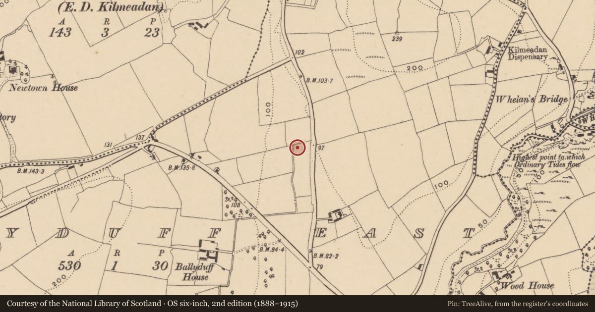
Slide toward Today to fade the historical sheet and see the modern map underneath.
David Rumsey Map Collection, Stanford LibrariesUniversity Library, Vrije Universiteit AmsterdamDavid Rumsey Map Collection, Stanford LibrariesDavid Rumsey Map Collection, Stanford Libraries
4 historical maps cover this location, the earliest the 1790 map "Composite: Ireland." (David Rumsey Map Collection, Stanford Libraries).
Historical maps covering this location
- 1790 · Composite: Ireland. (David Rumsey Map Collection, Stanford Libraries)
- 1882 · Ireland (southern half). (David Rumsey Map Collection, Stanford Libraries)
- 1891 · Ireland 16 (David Rumsey Map Collection, Stanford Libraries)
- 1911 · Sheet 14, 1911 (University Library, Vrije Universiteit Amsterdam)
This record in the National Monuments Service's Historic Environment Viewer ↗
The National Monuments Service's description
Situated in a low-lying landscape. Archaeological excavation (04E0225) as part of the N25 Waterford bypass produced a burnt mound spread (diam. 9m; T 0.2m) which covered an oval trough (dims. 1.85m x 1.3m; D 0.5m) filled with burnt muond material. Fulacht fia (WA017-130001-) is c. 10m to the N. (Hegarty et al. 2011)
Compiled by: Michael Moore.
Date of upload: 23rd December, 2010.
References
Hegarty, L. 2007 Ballyduff East (Site 43) and Adamstown: fulacht fiadh. In I. Bennett (Ed.) Excavations 2004: summary accounts of archaeological excavations in Ireland, 420, No. 1661. Dublin. Wordwell.
Long, P. and Hegarty, L. 2005 N25 Waterford Bypass. Contract 3. Preliminary report on archaeological investigations at Site 43 in the townland of Ballyduff East, Co. Waterford. Unpublished report. DEHLG (04E0225). Headland Archaeology.
Hegarty, L., Long., P and Price, J. 2011 Ballyduff East 43, Co. Waterford. In J. Eogan and E. Shee-Twohig (eds.), Cois tSiúire – nine thousand years of human activity in the lower Suir valley. Archaeological excavations on the N25 Waterford city bypass, vol. 2, 5. NRA road scheme: Monograph 8, Dublin.
Nearby in the register
- Fulacht fiaunder 1 mi
- Excavation - miscellaneousunder 1 mi
- Excavation - miscellaneousunder 1 mi
- Excavation - miscellaneousunder 1 mi
Other entries of the same register within about three miles of this one, by straight line.