Sites and Monuments Record · Ireland
Church
Coolfinn, County Waterford, Ireland
The record
- Townland
- Coolfinn
- County
- Waterford
- Country
- Ireland
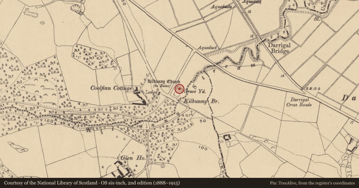
- First-edition OS map
- Kilbunny Church (in ruins)
- Latest-edition OS map
- Kilbunny Church (in Ruins)
- Coordinates
- 52.27153, -7.29429
- SMR number
- WA008-010001-
Slide toward Today to fade the historical sheet and see the modern map underneath.
David Rumsey Map Collection, Stanford LibrariesDavid Rumsey Map Collection, Stanford LibrariesDavid Rumsey Map Collection, Stanford LibrariesDavid Rumsey Map Collection, Stanford Libraries
4 historical maps cover this location, the earliest the 1790 map "Composite: Ireland." (David Rumsey Map Collection, Stanford Libraries).
Historical maps covering this location
- 1790 · Composite: Ireland. (David Rumsey Map Collection, Stanford Libraries)
- 1869 · Ireland. (David Rumsey Map Collection, Stanford Libraries)
- 1882 · Ireland (southern half). (David Rumsey Map Collection, Stanford Libraries)
- 1891 · Ireland 16 (David Rumsey Map Collection, Stanford Libraries)
This record in the National Monuments Service's Historic Environment Viewer ↗
The National Monuments Service's description
Situated at the edge of the floodplain of the River Suir with the W-E Kilbunny Stream 30-40m to the SE. The Romanesque parish church of Guilcagh is within a small rectangular graveyard (dims. c. 45m NE-SW; c. 30m NW-SE) defined by an earthen bank. The church of Foilinge was described as repaired in 1615 (Power 1913, 117). The church is a rectangular structure (ext. dims. 8.65m E-W; 5.87m N-S; wall H 1-3m) which was conserved in the early 1920s. A tapered W doorway (H 1.96m; Wth at base 0.78m; Wth at top 0.7m) has a round arch decorated with chevrons, a hood-moulding and cut-stone jambs with a pellet design. Each jamb has a capital decorated with an ornamental head - the N capital depicts a human, the S capital depicts a ram. N of the door-arch is a stone carved with the head of a lion, and a similar feature recorded S of the arch is now missing. There are two bullaun stones outside the doorway and an altar has been built into the E wall. An effigy of a bishop with the inscription S. MONNIA EPISCOPS, a 17th-century graveslab, fragments of a chest tomb, and two quern stones are now in the National Museum of Ireland or lost. (Martin 1874-5, 248-9; Power 1895b, 247-50; 1922; P. and Ed. 1911)
The above description is derived from the published 'Archaeological Inventory of County Waterford' (Dublin: Stationery Office, 1999), no. 1339. In certain instances the entries have been revised and updated in the light of recent research.
Date of upload/revision: 24 May 2011.
References
Power, Rev. P. 1922 Kilbunny church, Co. Waterford. Journal of the Royal Society of Antiquaries of Ireland 52, 77-80.
Power, Rev. P. 1895 The ancient ruined churches of Co. Waterford. Waterford and South East of Ireland Archaeological Journal 1, 133-41, 162-72, 247-53.
Power, Rev. P. 1913 Material condition of the churches of Waterford. Waterford and South East of Ireland Archaeological Journal 16, 114-23.
P. and Ed. 1911 Notes and queries - Effigy of St Munna at Kilbunny. Waterford and South East of Ireland Archaeological Journal 14, 192-3.
Martin, Dr. 1874-5 Proceedings and papers. Journal of the Royal Society of Antiquaries of Ireland 13, 247-50, 437, 479, 481.
Nearby in the register
- Tomb - effigialunder 1 mi
- Tomb - chest tombunder 1 mi
- Bullaun stoneunder 1 mi
- Bullaun stoneunder 1 mi
Other entries of the same register within about three miles of this one, by straight line.