Sites and Monuments Record · Ireland
Castle - tower house
Ardfinnan, County Tipperary South, Ireland
The record
- Townland
- Ardfinnan
- County
- Tipperary South
- Country
- Ireland
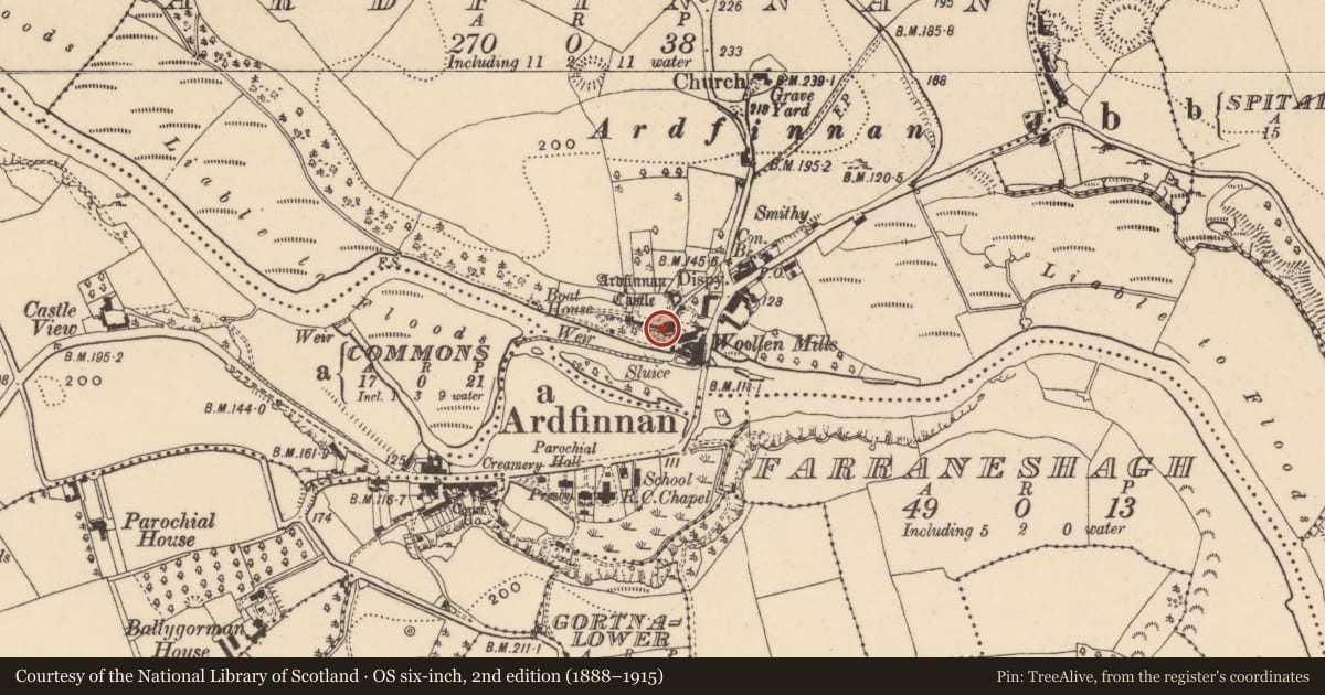
- First-edition OS map
- Ardfinnan Castle (in ruins)
- Latest-edition OS map
- Ardfinnan Castle
- Coordinates
- 52.31102, -7.88038
- SMR number
- TS088-001009-
Slide toward Today to fade the historical sheet and see the modern map underneath.
David Rumsey Map Collection, Stanford LibrariesDavid Rumsey Map Collection, Stanford LibrariesDavid Rumsey Map Collection, Stanford LibrariesDavid Rumsey Map Collection, Stanford Libraries
4 historical maps cover this location, the earliest the 1790 map "Composite: Ireland." (David Rumsey Map Collection, Stanford Libraries).
Historical maps covering this location
- 1790 · Composite: Ireland. (David Rumsey Map Collection, Stanford Libraries)
- 1882 · Ireland (southern half). (David Rumsey Map Collection, Stanford Libraries)
- 1891 · Ireland 16 (David Rumsey Map Collection, Stanford Libraries)
- 1904 · Sheet 13. (David Rumsey Map Collection, Stanford Libraries)
This record in the National Monuments Service's Historic Environment Viewer ↗
The National Monuments Service's description
On top of a massive rock outcrop overlooking the River Suir to the S, its strategic position dominating the settlement and bridge below. Ardfinnan Castle was beseiged during the Cromwellian wars in the mid-17th century (Killanin and Duignan 1967, 66). The tower house (ext. dims. c. 6m x 10m), still occupied, is built onto the SE angle of the bawn of the 13th-century castle (TS088-001001-). It is at least four storeys high and is rendered with plaster. None of the original fenestration is extant, with the possible exception of a loop in the E face. Visible original features include a series of crude dripstones in the top masonry courses and a pronounced base-batter. A caphouse runs N-S along the E wall. (Farrelly and FitzPatrick 1993, 1-5).
Compiled by: Jean Farrelly
Date of upload: 26 August 2011
References
Killanin, M.M. and Duignan, M.V. 1962 Shell Guide to Ireland. London. Ebury Press.
Farrelly, J. and FitzPatrick, E. 1993 Urban archaeological survey - county Tipperary (South Riding) (2 vols.). Unpublished report commissioned by the Office of Public Works, Dublin.
Nearby in the register
- Bawnunder 1 mi
- Castle - Anglo-Norman masonry castleunder 1 mi
- Mill - unclassifiedunder 1 mi
- Bridgeunder 1 mi
Other entries of the same register within about three miles of this one, by straight line.