Sites and Monuments Record · Ireland
Town defences
Town Parks, County Tipperary South, Ireland
The record
- Townland
- Town Parks
- County
- Tipperary South
- Country
- Ireland
- Latest-edition OS map
- Town Wall
- Coordinates
- 52.34669, -7.40865
- SMR number
- TS085-004032-
Slide toward Today to fade the historical sheet and see the modern map underneath.
David Rumsey Map Collection, Stanford LibrariesDavid Rumsey Map Collection, Stanford LibrariesDavid Rumsey Map Collection, Stanford LibrariesDavid Rumsey Map Collection, Stanford Libraries
4 historical maps cover this location, the earliest the 1790 map "Composite: Ireland." (David Rumsey Map Collection, Stanford Libraries).
Historical maps covering this location
- 1790 · Composite: Ireland. (David Rumsey Map Collection, Stanford Libraries)
- 1882 · Ireland (southern half). (David Rumsey Map Collection, Stanford Libraries)
- 1891 · Ireland 16 (David Rumsey Map Collection, Stanford Libraries)
- 1904 · Sheet 13. (David Rumsey Map Collection, Stanford Libraries)
This record in the National Monuments Service's Historic Environment Viewer ↗
The National Monuments Service's description
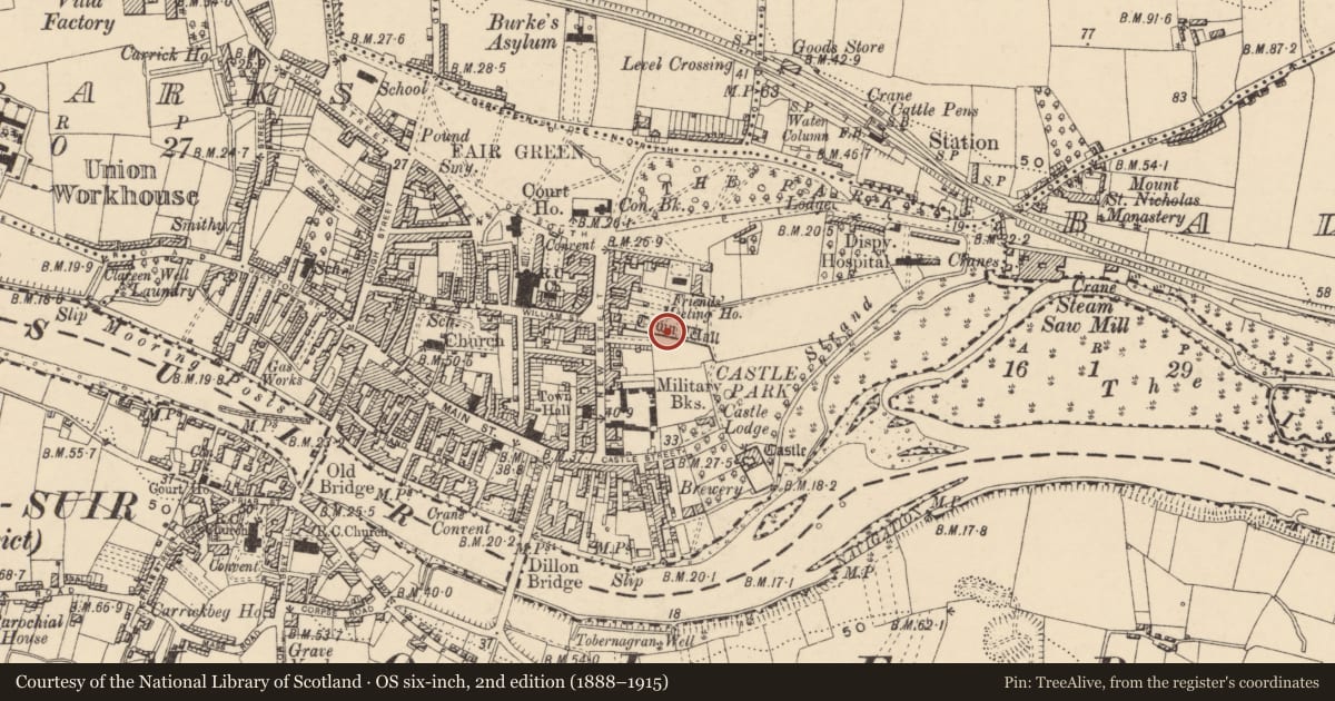
The earliest indication of the presence of a town wall in Carrick-on-Suir comes from a grant of 1343 which restored the right to collect murage (Bradley 1985, 40-42). There are further references to the town wall from the 14th century onwards, mainly occurring in property documents (Thomas 1992, vol. 2, 43-46). It appears that the town was enclosed on at least three sides. The River Suir possibly acted as a natural barrier to S, although Thomas (ibid.) suggests that there was also a wall running parallel to the river front. The total area enclosed would have been c. 15 hectares (Bradley 1985, 40-42). The northern section of the town wall ran, from where it survives in the NE corner, westward along William Street and Townwall Lane. The W and E portions of the town wall ran at right angles to the river. The former probably continued the line of Kickham Street and the latter, while running towards the river, appears to have intersected with the castle and may have been incorporated in the castles defences. Only one length of town wall survives intact, the section which formed the NE corner of the town defences, which forms the boundary of the present Tennis Club grounds. The northern length (L 162.2m; Wth 2.2m; max. H 4.15m), running from E to W, the wall then turns towards the S for a further length (L 17.25m). It is composed of randomly coursed rough sandstone and limestone blocks and rubble. Where the core is exposed it seems to consist of large lumps of sandstone. There was probably an internal wall-walk as there is an internal ledge along the northern length. Internally, at the corner of the wall there is a staircase constructed of large, very roughly cut limestone steps. The three bottom steps of which have collapsed recently. This staircase led up to a projecting look-out post or possibly a bartizan, although there are no apertures at its base for allowing missiles to be dropped on assailents. It is supported by four rough limestone corbels and stands at a height of 2.65m over the present ground level. The most westerly length of wall is leaning out dangerously and needs attention. It seems likely that there were at least four gates in the town wall. West gate (TS085-004033-), at the western end of Main Street survives as a placename and it is possible that there was an eastern gate (TS085-004035-) at the opposite end of Main Street (Thomas 1992, vol. 2, 43-46). It is also probable that there was a gate on New Street (TS085-004034-) where it intersects with the town wall and another gate at the southern end of Bridge Street (TS085-004036-) (Bradley 1985, 40-42). None of these gates have survived.
Compiled by: Jean Farrelly
Date of upload: 26 August 2011
References
Bradley, J. 1985 (Reprint 1997) The medieval towns of Tipperary. In W. Nolan and T.G. McGrath (eds), Tipperary: History and Society, 34-59. Dublin. Geography Publications.
Thomas, A. 1992 The walled towns of Ireland, 2 vols. Dublin. Irish Academic Press.
Nearby in the register
- House - 17th centuryunder 1 mi
- House - 16th centuryunder 1 mi
- Castle - Anglo-Norman masonry castleunder 1 mi
- Religious house - Franciscan nuns (Poor Clares)under 1 mi
Other entries of the same register within about three miles of this one, by straight line.