Sites and Monuments Record · Ireland
Graveslab
Town Parks, County Tipperary South, Ireland
The record
- Townland
- Town Parks
- County
- Tipperary South
- Country
- Ireland
- Latest-edition OS map
- Not indicated
- Coordinates
- 52.34646, -7.41376
- SMR number
- TS085-004020-
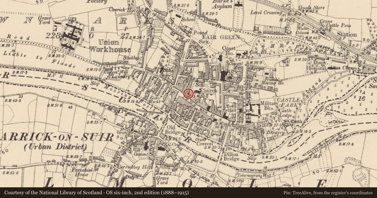
Slide toward Today to fade the historical sheet and see the modern map underneath.
David Rumsey Map Collection, Stanford LibrariesDavid Rumsey Map Collection, Stanford LibrariesDavid Rumsey Map Collection, Stanford LibrariesDavid Rumsey Map Collection, Stanford Libraries
4 historical maps cover this location, the earliest the 1790 map "Composite: Ireland." (David Rumsey Map Collection, Stanford Libraries).
Historical maps covering this location
- 1790 · Composite: Ireland. (David Rumsey Map Collection, Stanford Libraries)
- 1882 · Ireland (southern half). (David Rumsey Map Collection, Stanford Libraries)
- 1891 · Ireland 16 (David Rumsey Map Collection, Stanford Libraries)
- 1904 · Sheet 13. (David Rumsey Map Collection, Stanford Libraries)
This record in the National Monuments Service's Historic Environment Viewer ↗
The National Monuments Service's description
On the W side of the town, N of Main Street. The medieval church of St. Nicholas of Myra (TS085-004006-) appears to have survived until c. 1813 when it was demolished and replaced by a C of I church (O'Flanagan 1930, vol. 1, 63). Incorporated in the inner face of the W boundary wall of the church is the lower portion of a limestone graveslab (dims. 0.85m x 0.55m). It is decorated with a cross, only the calvary mount of which is visible. Within the curving mount are a skull and cross-bones in false relief. The cross shaft is not very clear. There is a marginal inscription which appears to read: I 1636 & .OA…. RODCES GENERO… NETA .ARCKI…OVOR. (Farrelly and FitzPatrick 1993).
Compiled by: Jean Farrelly
Date of upload: 26 August 2011
References
Farrelly, J. and FitzPatrick, E. 1993 Urban archaeological survey - county Tipperary (South Riding) (2 vols.). Unpublished report commissioned by the Office of Public Works, Dublin.
O'Flanagan, Rev. M. (Compiler) 1930 Letters containing information relative to the antiquities of the county of Tipperary collected during the progress of the Ordnance Survey in 1840. Bray.
Nearby in the register
- Graveslabunder 1 mi
- Graveslabunder 1 mi
- Graveslabunder 1 mi
- Tomb - chest tombunder 1 mi
Other entries of the same register within about three miles of this one, by straight line.