Sites and Monuments Record · Ireland
Ritual site - holy well
Ballynaraha, County Tipperary South, Ireland
The record
- Townland
- Ballynaraha
- County
- Tipperary South
- Country
- Ireland
- First-edition OS map
- Indicated
- Latest-edition OS map
- Indicated
- Coordinates
- 52.36190, -7.53342
- SMR number
- TS084-006----
Slide toward Today to fade the historical sheet and see the modern map underneath.
David Rumsey Map Collection, Stanford LibrariesDavid Rumsey Map Collection, Stanford LibrariesDavid Rumsey Map Collection, Stanford LibrariesDavid Rumsey Map Collection, Stanford Libraries
4 historical maps cover this location, the earliest the 1790 map "Composite: Ireland." (David Rumsey Map Collection, Stanford Libraries).
Historical maps covering this location
- 1790 · Composite: Ireland. (David Rumsey Map Collection, Stanford Libraries)
- 1882 · Ireland (southern half). (David Rumsey Map Collection, Stanford Libraries)
- 1891 · Ireland 16 (David Rumsey Map Collection, Stanford Libraries)
- 1904 · Sheet 13. (David Rumsey Map Collection, Stanford Libraries)
This record in the National Monuments Service's Historic Environment Viewer ↗
The National Monuments Service's description
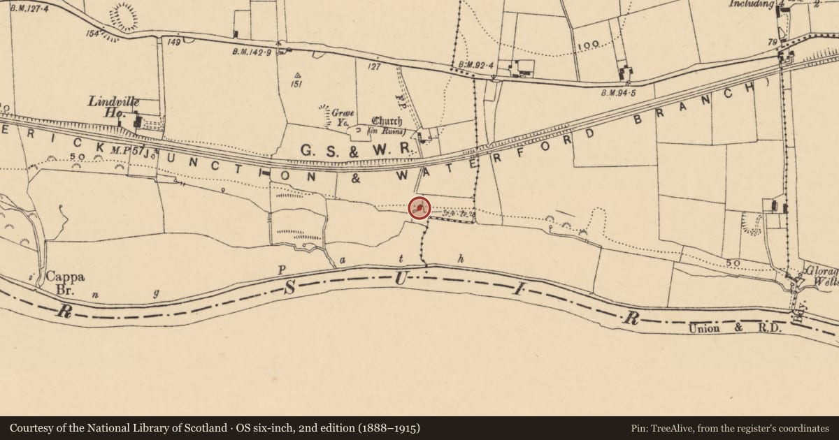
On a level flood plain of River Suir, on the N bank, in reclaimed marsh land used for grazing. According to Power (1907, 306) 'Tobar Naoimh Mharanáin (Mo Fhorannam) - "St. Forannan's Well": [is located] close by last [St. Brigid's Church]'. It is also mentioned in the OS Letters of 1840 as 'between this Church [TS084-005----] and the River Suire and about two hundred yards south of the former there is a holy well called St. Marannán's Well, but the Patron day is forgotten. The Saint after whom this well was called was Farannán, the Patron of Domhnach Mor Muighe Femhen' (O'Flanagan 1930, vol. 1, 61). This well could not be located at the time of inspection.
Compiled by: Jean Farrelly
Date of revised upload: 21 October 2014
References
Power, Rev. P. 1907 Place names of the Decies. WAJ. 10, 14- ?, 88-134, 184-240, 263-310.
O'Flanagan, Rev. M. (Compiler) 1930 Letters containing information relative to the antiquities of the county of Tipperary collected during the progress of the Ordnance Survey in 1840. Bray.
Nearby in the register
- Graveyardunder 1 mi
- Churchunder 1 mi
- Armorial plaqueunder 1 mi
- Castle - tower houseunder 1 mi
Other entries of the same register within about three miles of this one, by straight line.