Sites and Monuments Record · Ireland
Graveslab
Burgagery-Lands West, County Tipperary South, Ireland
The record
- Townland
- Burgagery-Lands West
- County
- Tipperary South
- Country
- Ireland
- First-edition OS map
- Not indicated
- Latest-edition OS map
- Not indicated
- Coordinates
- 52.35405, -7.70634
- SMR number
- TS083-019025-
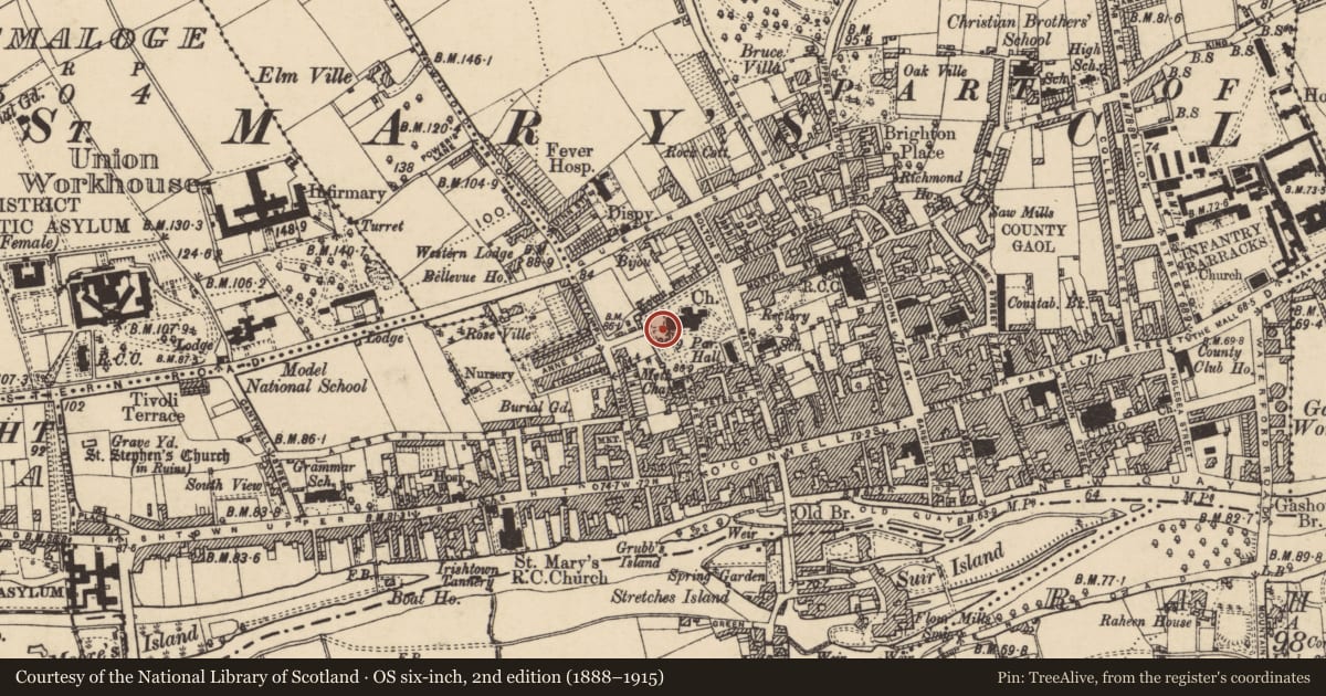
Slide toward Today to fade the historical sheet and see the modern map underneath.
David Rumsey Map Collection, Stanford LibrariesDavid Rumsey Map Collection, Stanford LibrariesDavid Rumsey Map Collection, Stanford LibrariesDavid Rumsey Map Collection, Stanford Libraries
4 historical maps cover this location, the earliest the 1790 map "Composite: Ireland." (David Rumsey Map Collection, Stanford Libraries).
Historical maps covering this location
- 1790 · Composite: Ireland. (David Rumsey Map Collection, Stanford Libraries)
- 1882 · Ireland (southern half). (David Rumsey Map Collection, Stanford Libraries)
- 1891 · Ireland 16 (David Rumsey Map Collection, Stanford Libraries)
- 1904 · Sheet 13. (David Rumsey Map Collection, Stanford Libraries)
This record in the National Monuments Service's Historic Environment Viewer ↗
The National Monuments Service's description
Located within St. Mary's church (TS083-019001-), in the SW angle of the S aisle is the burial slab of John White and his wife Johanna. The slab is currently under a light wooden floor covered by carpet. The slab is decribed by Holland (1992, 200) as having 'a cross with a crown of thorns, the symbols of the Passion and two shields. One, on the left, has the White coat of arms with three roses and a chevron which, although badly rubbed, is almost certainly not engrailed. The other coat of arms, presumably his wife's, is on the other side of the cross's shaft and is also badly rubbed, but seems to have been a lion passant gardant with the initials T.C. (Burke 1907, 268). Kearney's report (Graves 1857, 360) of a similar and third coat of arms cannot be confirmed because of the state of the stone, and the reported initials 'I W' on the White coat of arms (Burke 1907, 268) are also unclear'. The poorly preserved latin inscription around the border has been transcribed as: JOHANNIS GELIDE JACET HOC SUB MARMORE VITUS CHARA QUAE JOHANNAE CONJUGIO OSSA PIAE. BIS MAIOR, WENTWORTH PRIMUM PRO REGE SECUNDUM CATHOLICI SUBIENS FOEDERA MARTIS OBIIT 28 AUGUSTI 1643 (Bagwell and Clarke, 1890, vol. 1, 242) and translated as, 'John White lies beneath this icy marble, and also the bones of his beloved wife Johanna, he was the mayor twice. First during the viceroyalty of Wentworth. Second, at the beginning of the Catholic Confederate War. He died 26 August 1643' (Art, Craft and Design Class 1996, 20).
Compiled by: Jean Farrelly
Date of revised upload: 06 February 2012
References
Holland, P. 1992 A carved stone and other late medieval fragments in Clonmel. Tipperary Historical Journal, 197-201.
Burke, Rev. W. P. 1907 History of Clonmel. The Clonmel Library Committee.
Graves, Rev. J. 1856-7 Proceedings and papers. Journal of the Royal Society of Antiquaries of Ireland 4, 359-61.
Vigors, P. D. 1888-91 County Tipperary: parish of Clonmel. Jour. of the Assoc. for the Preservation of the Memorials of the Dead, vol. 1, 239-43.
Art, Craft and Design Class 1996 Old St Marys Memories and Images. Central Technical Institute, Clonmel.
Nearby in the register
- Tomb - chest tomb (present location)under 1 mi
- Wall monumentunder 1 mi
- Graveslabunder 1 mi
- Graveslabunder 1 mi
Other entries of the same register within about three miles of this one, by straight line.