Sites and Monuments Record · Ireland
House - 16th/17th century
Burgagery-Lands West, County Tipperary South, Ireland
The record
- Townland
- Burgagery-Lands West
- County
- Tipperary South
- Country
- Ireland
- First-edition OS map
- Indicated
- Latest-edition OS map
- Indicated
- Coordinates
- 52.35266, -7.70442
- SMR number
- TS083-019007-
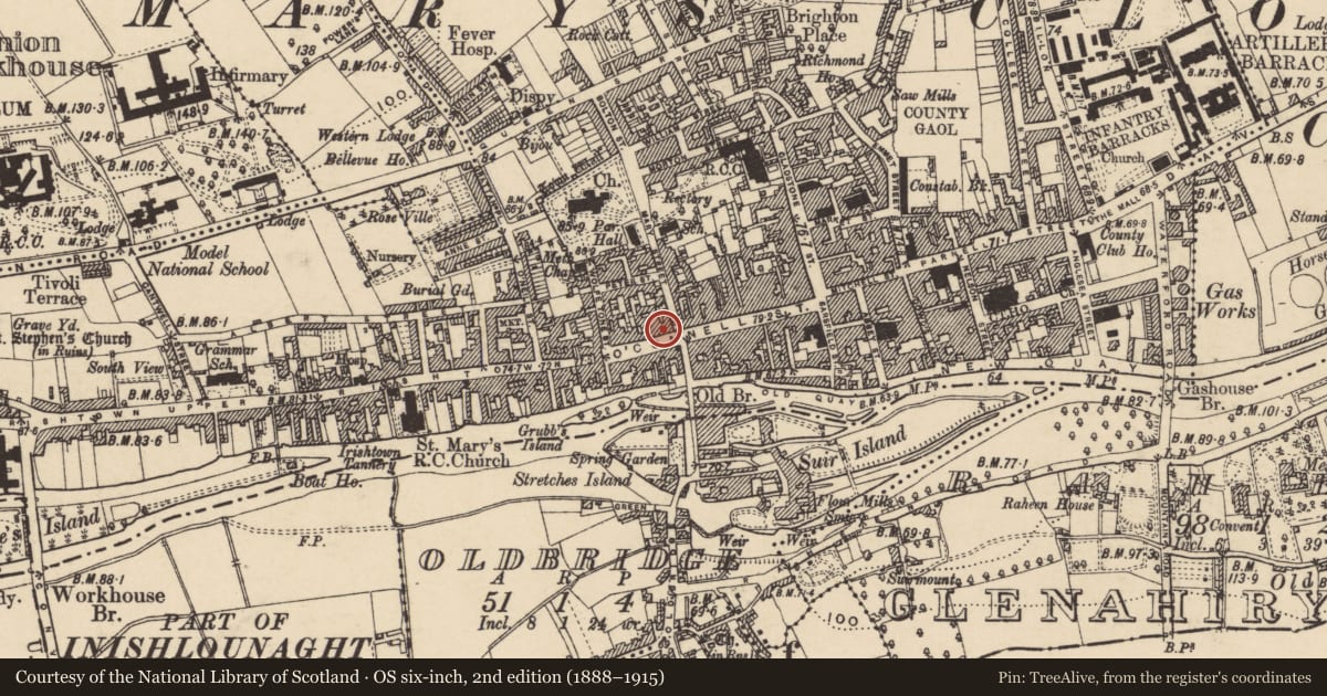
Slide toward Today to fade the historical sheet and see the modern map underneath.
David Rumsey Map Collection, Stanford LibrariesDavid Rumsey Map Collection, Stanford LibrariesDavid Rumsey Map Collection, Stanford LibrariesDavid Rumsey Map Collection, Stanford Libraries
4 historical maps cover this location, the earliest the 1790 map "Composite: Ireland." (David Rumsey Map Collection, Stanford Libraries).
Historical maps covering this location
- 1790 · Composite: Ireland. (David Rumsey Map Collection, Stanford Libraries)
- 1882 · Ireland (southern half). (David Rumsey Map Collection, Stanford Libraries)
- 1891 · Ireland 16 (David Rumsey Map Collection, Stanford Libraries)
- 1904 · Sheet 13. (David Rumsey Map Collection, Stanford Libraries)
This record in the National Monuments Service's Historic Environment Viewer ↗
The National Monuments Service's description
No. 57/58 O'Connell St, located at the junction of O'Connell St. and Mary's Street. Two-storey building rendered with plaster. Two-light sandstone window (dims. 1.4m x 0.85m) with hood-moulding at first-floor level in N wall (rear wall of building) (Holland 1994, 176). Central mullion missing. The window reveal is 0.22m deep and there are two glazing-bar holes on the soffit. On NE angle of E gable there is a fragment of a cornice which formerly ran horizontally around the gable. Beneath it there is a corbel projecting out of the wall suggesting that there was an adjoining structure on this side. W half of building was accessed internally, it has been modernised with several partition walls inserted. Surviving early features suggest a 16th/early 17th-century date for this building. Since this building was inspected in 1993 an extension has been built onto the rear elevation incorporating the late 16th-17th-century window and obscuring it from external view.
Compiled by: Jean Farrelly
Date of upload: 26 August 2011
References
Holland, P. 1994 Late medieval structures in Clonmel: further remarks. Tipperary Historical Journal, 175-7.
Lyons, P. 1936 Norman antiquities of Clonmel burgh. Journal of the Royal Society of Antiquaries of Ireland 66, 285-94.
Lyons, P. 1954-5 The burgh of Clonmel. Journal of the Clonmel Historical and Archaeological Society, 3, 20-27.
Farrelly, J. and FitzPatrick, E. 1993 Urban archaeological survey - county Tipperary (South Riding) (2 vols.). Unpublished report commissioned by the Office of Public Works, Dublin.
Nearby in the register
- Town hallunder 1 mi
- Middenunder 1 mi
- House - 16th/17th centuryunder 1 mi
- House - medievalunder 1 mi
Other entries of the same register within about three miles of this one, by straight line.