Sites and Monuments Record · Ireland
Ringfort - rath
Ballyhickey, County Tipperary South, Ireland
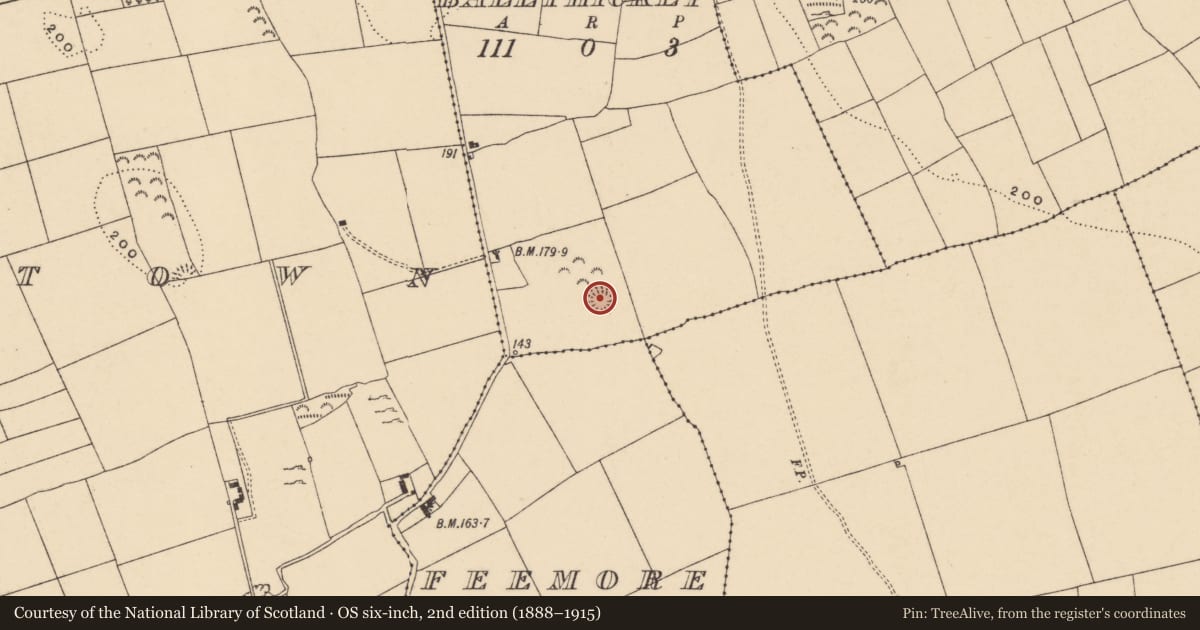
The record
- Townland
- Ballyhickey
- County
- Tipperary South
- Country
- Ireland
- First-edition OS map
- Hachured
- Latest-edition OS map
- Hachured
- Coordinates
- 52.33019, -7.87397
- SMR number
- TS082-057----
Slide toward Today to fade the historical sheet and see the modern map underneath.
David Rumsey Map Collection, Stanford LibrariesDavid Rumsey Map Collection, Stanford LibrariesDavid Rumsey Map Collection, Stanford LibrariesDavid Rumsey Map Collection, Stanford Libraries
4 historical maps cover this location, the earliest the 1790 map "Composite: Ireland." (David Rumsey Map Collection, Stanford Libraries).
Historical maps covering this location
- 1790 · Composite: Ireland. (David Rumsey Map Collection, Stanford Libraries)
- 1882 · Ireland (southern half). (David Rumsey Map Collection, Stanford Libraries)
- 1891 · Ireland 16 (David Rumsey Map Collection, Stanford Libraries)
- 1904 · Sheet 13. (David Rumsey Map Collection, Stanford Libraries)
This record in the National Monuments Service's Historic Environment Viewer ↗
The National Monuments Service's description
On flat ground at the S edge of a N-S ridge, in pasture. Circular enclosure (diam. 32.7m N-S; 33.4m E-W) defined by a bank (Wth 2.7m; int. H 0.44m; ext. H 0.91m) with a high stone content and a wide shallow fosse (Wth 4.7m at top, 2.8m at base; D 0.23m). It has a flat interior and is planted with mature conifers on the inner edge of the bank with a second round of planting immediately inside, also one tree in the centre. There is an entrance in the SSW (Wth 2.5m). Clear stone revetment on inner face in E quadrant. The monument is badly eroded by cattle, the bank is denuded and there is no grass growing in the interior. While this monument has ornamental planting it is likely to be a ringfort reused as a tree-ring. On the 1st (1840) ed. OS 6-inch map the enclosure is shown with a field boundary immediately to the N and W, this boundary deliberately kinks out to accommodate the ringfort.
Compiled by: Jean Farrelly
Date of upload: 10 February 2014
Nearby in the register
- Enclosureunder 1 mi
- Enclosureunder 1 mi
- Enclosureunder 1 mi
- Ringfort - rathunder 1 mi
Other entries of the same register within about three miles of this one, by straight line.