Sites and Monuments Record · Ireland
Castle - ringwork
Heathview, County Tipperary South, Ireland
The record
- Townland
- Heathview
- County
- Tipperary South
- Country
- Ireland
- First-edition OS map
- Not indicated
- Latest-edition OS map
- Hachured
- Coordinates
- 52.41584, -7.48654
- SMR number
- TS078-020----
Slide toward Today to fade the historical sheet and see the modern map underneath.
David Rumsey Map Collection, Stanford LibrariesDavid Rumsey Map Collection, Stanford LibrariesDavid Rumsey Map Collection, Stanford LibrariesDavid Rumsey Map Collection, Stanford Libraries
4 historical maps cover this location, the earliest the 1790 map "Composite: Ireland." (David Rumsey Map Collection, Stanford Libraries).
Historical maps covering this location
- 1790 · Composite: Ireland. (David Rumsey Map Collection, Stanford Libraries)
- 1882 · Ireland (southern half). (David Rumsey Map Collection, Stanford Libraries)
- 1891 · Ireland 16 (David Rumsey Map Collection, Stanford Libraries)
- 1904 · Sheet 13. (David Rumsey Map Collection, Stanford Libraries)
This record in the National Monuments Service's Historic Environment Viewer ↗
The National Monuments Service's description
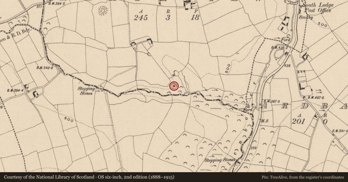
On high ground, utilising a natural spur or promontory, overlooking steep river gorge to N, E and S. This promontory was cut off from the ridge along the W-NW sector by a fosse (Wth 8.8m; D c. 2m). The ringwork is largely defined by a steep natural scarp, though along the NW side it is defined by an earthen bank (Wth 2.7m crest, 4.5m base; H above int. 0.56m; H above ext. 1.7-1.93m), there is a lot of shale in the bank construction. At the base of the NE slope (H 5m) there is a berm (Wth 3.6m) with a stoney bank (L 20.5m; Wth 4.64m; int. H 0.86m; ext. H 3.5m) at the edge of a further natural fall. Monument heavily overgrown with brambles, bracken and scrub around the edge and in interior (diam. 29m N-S; 37m WNW-ESE from 25-inch OS map). Ringwork is roughly triangular in plan, as depicted on 2nd (1901-05) ed. OS 6-inch map. Entrance (Wth 1.7m) in the W quadrant. Refuse has been dumped outside the NW quadrant. There appears to be a large pit in SE quadrant of the interior with mound of upcast immediately N of this. This monument is locally known as 'the old castle'.
Compiled by: Jean Farrelly
Date of upload: 19 December 2013
Nearby in the register
- Concentric enclosureunder 1 mi
- Souterrainunder 1 mi
- Castle - ringworkunder 1 mi
- Concentric enclosureunder 1 mi
Other entries of the same register within about three miles of this one, by straight line.