Sites and Monuments Record · Ireland
Ringfort - rath
Ballincor (Colman Par.),Ballinlough (Colman Par.), County Tipperary South, Ireland
The record
- Townland
- Ballincor (Colman Par.),Ballinlough (Colman Par.)
- County
- Tipperary South
- Country
- Ireland
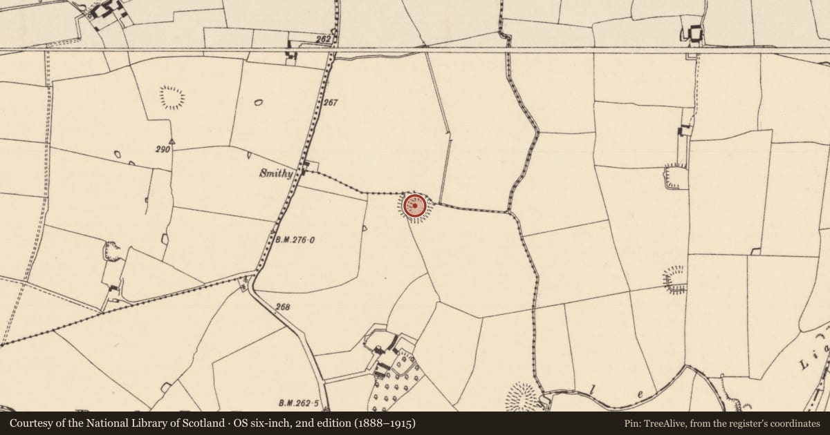
- First-edition OS map
- Indicated
- Latest-edition OS map
- Hachured
- Coordinates
- 52.42606, -7.72852
- SMR number
- TS077-002----
Slide toward Today to fade the historical sheet and see the modern map underneath.
David Rumsey Map Collection, Stanford LibrariesDavid Rumsey Map Collection, Stanford LibrariesDavid Rumsey Map Collection, Stanford LibrariesDavid Rumsey Map Collection, Stanford Libraries
4 historical maps cover this location, the earliest the 1790 map "Composite: Ireland." (David Rumsey Map Collection, Stanford Libraries).
Historical maps covering this location
- 1790 · Composite: Ireland. (David Rumsey Map Collection, Stanford Libraries)
- 1882 · Ireland (southern half). (David Rumsey Map Collection, Stanford Libraries)
- 1891 · Ireland 16 (David Rumsey Map Collection, Stanford Libraries)
- 1904 · Sheet 13. (David Rumsey Map Collection, Stanford Libraries)
This record in the National Monuments Service's Historic Environment Viewer ↗
The National Monuments Service's description
In flat pasture on broad ridge in gently undulating terrain. Well-preserved univallate ringfort. Roughly circular area (diam. 44m N-S; 48.7m E-W) enclosed by a broad, high bank (Wth 2.8m crest, 7.6m base; int. H 1.17m; ext. H 2.72m) and wide shallow fosse (Wth 2.9m; D 0.86m), waterlogged along W side. Trees growing on bank. Interior grass-covered with some nettles. Portion of bank removed in NW quadrant where two field boundaries meet. Break (Wth 2m) in bank in SSW quadrant, the fosse appears to have been filled up with a later fosse immediately SSW and a modern, stone revetted, causeway with drain built across the latter. Post and barbed wire fence runs along top of bank in N quadrant. External fosse in N quadrant has a sharp profile, possible re-cut. Bank in NE sector has been levelled and external fosse filled in, field bank runs NNW-SSE up to N side of this break. Bank denuded at SSE but not broken through.
Compiled by: Jean Farrelly
Date of upload: 26 August 2011
Nearby in the register
- Ringfort - rathunder 1 mi
- Moated siteunder 1 mi
- Moated siteunder 1 mi
- Ringfort - rathunder 1 mi
Other entries of the same register within about three miles of this one, by straight line.